Fagnières geodata
Fagnières (Grand Est) is a populated place; located in France in Europe/Paris (GMT+2) time zone. With population of 4,783 people, there are 2076 cities with bigger population in this country. Compared to other cities in France, 78.9% of cities are located further ↓South; 70.8% of cities are located further ←West and 65.3% of cities have higher elevation than Fagnières. Note1
Administrative division(s):
- Level 1: Grand Est
- Level 2: Marne
- Level 3: Arrondissement de Châlons-en-Champagne
- Level 4: Fagnières


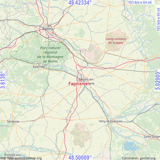
Fagnières GPS coordinates[2]
48° 57' 49.86" North, 4° 19' 0.912" East
| Map corner | latitude | longitude |
|---|---|---|
| Upper-left | 49.42334°, | 3.6138° |
| Center: | 48.96385°, | 4.31692° |
| Lower-right: | 48.50009°, | 5.02005° |
| Map W x H: | 102.7×102.7 km | = 63.8×63.8mi |
| max Lat: | 51.07786° ⇑21.1% North |
| Fagnières: | 48.96385° |
| min Lat: | ⇓78.9% South 41.3874° |
| min Long | Fagnières | max Long |
| -5.08615° | 4.31692° | 9.52242° |
| W 70.8%⇐ | ⇒29.2% E |
Elevation
Elevation of Fagnières is 89 m = 292 ft, and this is 104.7 m = 344 ft below average elevation for this country.
| Max E: |
2333 m = 7654 ft | 65.3% |
| Avg. | 193.7 m = 635 ft | |
| Fagnières | 89 m = 292 ft | |
Min E: |
-1 m = -3 ft | 34.7% |
See also: France elevation on elevation.city.
Geographical zone
Fagnières is located in North temperate zone (between Tropic of Cancer and the Arctic Circle). Distance of this North polar circle is 1956.9 km =1216 mi to North.| Distance of | km | miles | from Fagnières |
|---|---|---|---|
| North Pole | 4562.8 | 2835.2 | to North |
| Arctic Circle | 1956.9 | 1216 | to North |
| Tropic Cancer | 2838.4 | 1763.7 | to South |
| Equator | 5444.3 | 3382.9 | to South |


Nearby cities:
15 places around Fagnières: (largest is in red/bold)
• Châlons-en-Champagne
3.8 km =2.4 mi,  106°
106°
• Compertrix
3.3 km =2.1 mi,  138°
138°
• Condé-sur-Marne
13.4 km =8.3 mi,  311°
311°
• Juvigny
7.3 km =4.5 mi,  327°
327°
• Jâlons
10.8 km =6.7 mi,  298°
298°
• La Veuve
7.4 km =4.6 mi,  0°
0°
• L’Épine
11.4 km =7.1 mi,  81°
81°
• Mairy-sur-Marne
11.5 km =7.1 mi, 143°
• Matougues
6.4 km =4 mi, 301°
• Moncetz-Longevas
10 km =6.2 mi,  127°
127°
• Recy
2.8 km =1.7 mi,  355°
355°
• Saint-Germain-la-Ville
13.2 km =8.2 mi, 133°
• Saint-Martin-sur-le-Pré
2.2 km =1.4 mi,  47°
47°
• Saint-Memmie
5.1 km =3.2 mi,  104°
104°
• Sarry
8.2 km =5.1 mi, 127°
Sources, notices
• [Note1] Compared only with cities in France existing in our database
• [Src1] Map data: © OpenStreetMap contributors (CC-BY-SA)
• [Src2] Other city data from geonames.org with taken over terms of usage.
• [Src3] Geographical zone / Annual Mean Temperature by Robert A. Rohde @ Wikipedia
