Mirecourt geodata
Mirecourt (Grand Est) is a populated place; located in France in Europe/Paris (GMT+2) time zone. With population of 6,998 people, there are 1404 cities with bigger population in this country. Compared to other cities in France, 64.6% of cities are located further ↓South; 88.6% of cities are located further ←West and 79.2% of cities have lower elevation than Mirecourt. Note1
Administrative division(s):
- Level 1: Grand Est
- Level 2: Vosges
- Level 3: Arrondissement de Neufchâteau
- Level 4: Mirecourt


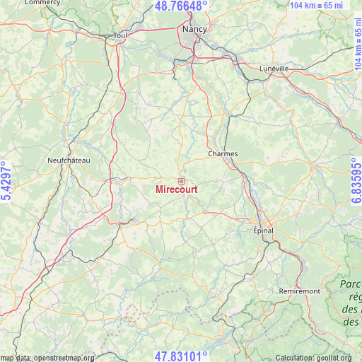
Mirecourt GPS coordinates[2]
48° 18' 3.204" North, 6° 7' 58.152" East
| Map corner | latitude | longitude |
|---|---|---|
| Upper-left | 48.76648°, | 5.4297° |
| Center: | 48.30089°, | 6.13282° |
| Lower-right: | 47.83101°, | 6.83595° |
| Map W x H: | 104×104 km | = 64.6×64.6mi |
| max Lat: | 51.07786° ⇑35.4% North |
| Mirecourt: | 48.30089° |
| min Lat: | ⇓64.6% South 41.3874° |
| min Long | Mirecourt | max Long |
| -5.08615° | 6.13282° | 9.52242° |
| W 88.6%⇐ | ⇒11.4% E |
Elevation
Elevation of Mirecourt is 282 m = 925 ft, and this is 88.3 m = 290 ft above average elevation for this country.
| Max E: |
2333 m = 7654 ft | 20.8% |
| Mirecourt | 282 m 925 ft | |
| Avg. | 193.7 m = 635 ft | |
Min E: |
-1 m = -3 ft | 79.2% |
See also: France elevation on elevation.city.
Geographical zone
Mirecourt is located in North temperate zone (between Tropic of Cancer and the Arctic Circle). Distance of this North polar circle is 2030.6 km =1261.8 mi to North.| Distance of | km | miles | from Mirecourt |
|---|---|---|---|
| North Pole | 4636.5 | 2881 | to North |
| Arctic Circle | 2030.6 | 1261.8 | to North |
| Tropic Cancer | 2764.6 | 1717.8 | to South |
| Equator | 5370.6 | 3337.1 | to South |


Nearby cities:
15 places around Mirecourt: (largest is in red/bold)
• Charmes
14.1 km =8.8 mi,  55°
55°
• Châtel-sur-Moselle
19.4 km =12.1 mi,  85°
85°
• Dompaire
10.6 km =6.6 mi,  142°
142°
• Essegney
15.5 km =9.6 mi, 61°
• Gironcourt-sur-Vraine
14.8 km =9.2 mi,  274°
274°
• Harol
18.6 km =11.6 mi,  152°
152°
• Hymont
3.8 km =2.4 mi,  170°
170°
• Mattaincourt
2.2 km =1.4 mi,  182°
182°
• Nomexy
18.7 km =11.6 mi, 87°
• Portieux
16.4 km =10.2 mi,  72°
72°
• Poussay
2.2 km =1.4 mi,  342°
342°
• Remoncourt
10 km =6.2 mi,  217°
217°
• Tantonville
18.8 km =11.7 mi,  1°
1°
• Vincey
15.2 km =9.4 mi, 74°
• Vittel
17.6 km =10.9 mi,  230°
230°
Sources, notices
• [Note1] Compared only with cities in France existing in our database
• [Src1] Map data: © OpenStreetMap contributors (CC-BY-SA)
• [Src2] Other city data from geonames.org with taken over terms of usage.
• [Src3] Geographical zone / Annual Mean Temperature by Robert A. Rohde @ Wikipedia
