Portieux geodata
Portieux (Grand Est) is a populated place; located in France in Europe/Paris (GMT+2) time zone. With population of 1,300 people, there are 7031 cities with bigger population in this country. Compared to other cities in France, 65.4% of cities are located further ↓South; 90.6% of cities are located further ←West and 80.5% of cities have lower elevation than Portieux. Note1
Administrative division(s):
- Level 1: Grand Est
- Level 2: Vosges
- Level 3: Arrondissement d’Épinal
- Level 4: Portieux


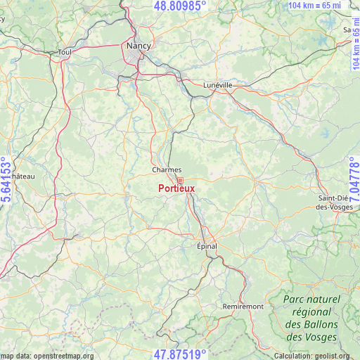
Portieux GPS coordinates[2]
48° 20' 40.776" North, 6° 20' 40.74" East
| Map corner | latitude | longitude |
|---|---|---|
| Upper-left | 48.80985°, | 5.64153° |
| Center: | 48.34466°, | 6.34465° |
| Lower-right: | 47.87519°, | 7.04778° |
| Map W x H: | 103.9×103.9 km | = 64.6×64.6mi |
| max Lat: | 51.07786° ⇑34.6% North |
| Portieux: | 48.34466° |
| min Lat: | ⇓65.4% South 41.3874° |
| min Long | Portieux | max Long |
| -5.08615° | 6.34465° | 9.52242° |
| W 90.6%⇐ | ⇒9.4% E |
Elevation
Elevation of Portieux is 296 m = 971 ft, and this is 102.3 m = 336 ft above average elevation for this country.
| Max E: |
2333 m = 7654 ft | 19.5% |
| Portieux | 296 m 971 ft | |
| Avg. | 193.7 m = 635 ft | |
Min E: |
-1 m = -3 ft | 80.5% |
See also: France elevation on elevation.city.
Geographical zone
Portieux is located in North temperate zone (between Tropic of Cancer and the Arctic Circle). Distance of this North polar circle is 2025.8 km =1258.8 mi to North.| Distance of | km | miles | from Portieux |
|---|---|---|---|
| North Pole | 4631.6 | 2877.9 | to North |
| Arctic Circle | 2025.8 | 1258.8 | to North |
| Tropic Cancer | 2769.5 | 1720.9 | to South |
| Equator | 5375.4 | 3340.1 | to South |


Nearby cities:
15 places around Portieux: (largest is in red/bold)
• Bayon
14.6 km =9.1 mi,  351°
351°
• Charmes
5 km =3.1 mi,  307°
307°
• Chavelot
14.1 km =8.8 mi,  150°
150°
• Châtel-sur-Moselle
5 km =3.1 mi,  132°
132°
• Darnieulles
16.1 km =10 mi,  178°
178°
• Dogneville
16 km =9.9 mi, 147°
• Dompaire
16.3 km =10.1 mi,  214°
214°
• Essegney
3.3 km =2.1 mi,  321°
321°
• Girmont
11.8 km =7.3 mi,  143°
143°
• Igney
8.8 km =5.5 mi, 154°
• Mirecourt
16.4 km =10.2 mi,  252°
252°
• Nomexy
5.1 km =3.2 mi, 143°
• Roville-devant-Bayon
14.2 km =8.8 mi,  343°
343°
• Thaon-les-Vosges
11.8 km =7.3 mi, 153°
• Vincey
1.3 km =0.8 mi,  230°
230°
Sources, notices
• [Note1] Compared only with cities in France existing in our database
• [Src1] Map data: © OpenStreetMap contributors (CC-BY-SA)
• [Src2] Other city data from geonames.org with taken over terms of usage.
• [Src3] Geographical zone / Annual Mean Temperature by Robert A. Rohde @ Wikipedia
