Mimet geodata
Mimet (Provence-Alpes-Côte d'Azur) is a populated place; located in France in Europe/Paris (GMT+2) time zone. With population of 4,505 people, there are 2190 cities with bigger population in this country. Compared to other cities in France, 94.1% of cities are located further ↑North; 82.9% of cities are located further ←West and 92.7% of cities have lower elevation than Mimet. Note1
Administrative division(s):
- Level 1: Provence-Alpes-Côte d'Azur
- Level 2: Département des Bouches-du-Rhône
- Level 3: Aix-en-Provence
- Level 4: Mimet


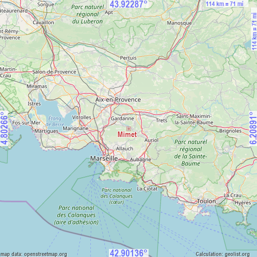
Mimet GPS coordinates[2]
43° 24' 51.372" North, 5° 30' 20.844" East
| Map corner | latitude | longitude |
|---|---|---|
| Upper-left | 43.92287°, | 4.80266° |
| Center: | 43.41427°, | 5.50579° |
| Lower-right: | 42.90136°, | 6.20891° |
| Map W x H: | 113.6×113.6 km | = 70.6×70.6mi |
| max Lat: | 51.07786° ⇑94.1% North |
| Mimet: | 43.41427° |
| min Lat: | ⇓5.9% South 41.3874° |
| min Long | Mimet | max Long |
| -5.08615° | 5.50579° | 9.52242° |
| W 82.9%⇐ | ⇒17.1% E |
Elevation
Elevation of Mimet is 497 m = 1631 ft, and this is 303.3 m = 995 ft above average elevation for this country.
| Max E: |
2333 m = 7654 ft | 7.3% |
| Mimet | 497 m 1631 ft | |
| Avg. | 193.7 m = 635 ft | |
Min E: |
-1 m = -3 ft | 92.7% |
See also: France elevation on elevation.city.
Geographical zone
Mimet is located in North temperate zone (between Tropic of Cancer and the Arctic Circle). Distance of this Northern Tropic circle is 2221.3 km =1380.3 mi to South.| Distance of | km | miles | from Mimet |
|---|---|---|---|
| North Pole | 5179.8 | 3218.6 | to North |
| Arctic Circle | 2574 | 1599.4 | to North |
| Tropic Cancer | 2221.3 | 1380.3 | to South |
| Equator | 4827.2 | 2999.5 | to South |


Nearby cities:
15 places around Mimet: (largest is in red/bold)
• Belcodène
6.8 km =4.2 mi,  78°
78°
• Bouc-Bel-Air
8.6 km =5.3 mi,  299°
299°
• Cadolive
3.7 km =2.3 mi,  121°
121°
• Fuveau
6.4 km =4 mi,  44°
44°
• Gardanne
5.4 km =3.4 mi,  326°
326°
• Gréasque
3.8 km =2.4 mi,  56°
56°
• La Bouilladisse
7.3 km =4.5 mi,  105°
105°
• Les Médecins
7.8 km =4.8 mi,  211°
211°
• Meyreuil
8.2 km =5.1 mi,  354°
354°
• Mouret
8.5 km =5.3 mi,  226°
226°
• Palama
7.3 km =4.5 mi,  222°
222°
• Peypin
6.7 km =4.2 mi, 119°
• Plan-de-Cuques
8.2 km =5.1 mi,  204°
204°
• Saint-Savournin
1.8 km =1.1 mi, 110°
• Simiane-Collongue
6 km =3.7 mi,  287°
287°
Sources, notices
• [Note1] Compared only with cities in France existing in our database
• [Src1] Map data: © OpenStreetMap contributors (CC-BY-SA)
• [Src2] Other city data from geonames.org with taken over terms of usage.
• [Src3] Geographical zone / Annual Mean Temperature by Robert A. Rohde @ Wikipedia
