Peypin geodata
Peypin (Provence-Alpes-Côte d'Azur) is a populated place; located in France in Europe/Paris (GMT+2) time zone. With population of 5,133 people, there are 1913 cities with bigger population in this country. Compared to other cities in France, 94.4% of cities are located further ↑North; 83.5% of cities are located further ←West and 80.1% of cities have lower elevation than Peypin. Note1
Administrative division(s):
- Level 1: Provence-Alpes-Côte d'Azur
- Level 2: Département des Bouches-du-Rhône
- Level 3: Arrondissement de Marseille
- Level 4: Peypin


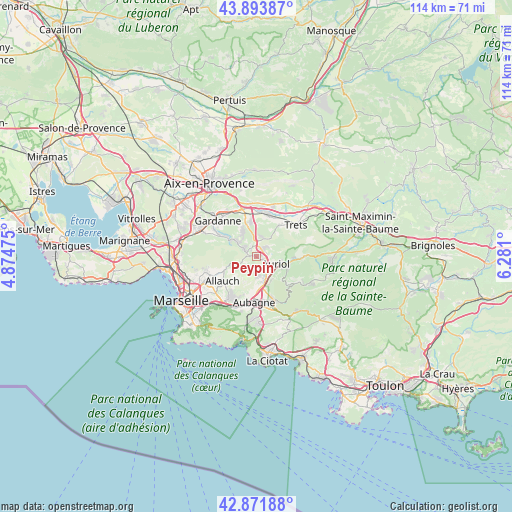
Peypin GPS coordinates[2]
43° 23' 6.108" North, 5° 34' 40.368" East
| Map corner | latitude | longitude |
|---|---|---|
| Upper-left | 43.89387°, | 4.87475° |
| Center: | 43.38503°, | 5.57788° |
| Lower-right: | 42.87188°, | 6.281° |
| Map W x H: | 113.6×113.6 km | = 70.6×70.6mi |
| max Lat: | 51.07786° ⇑94.4% North |
| Peypin: | 43.38503° |
| min Lat: | ⇓5.6% South 41.3874° |
| min Long | Peypin | max Long |
| -5.08615° | 5.57788° | 9.52242° |
| W 83.5%⇐ | ⇒16.5% E |
Elevation
Elevation of Peypin is 291 m = 955 ft, and this is 97.3 m = 319 ft above average elevation for this country.
| Max E: |
2333 m = 7654 ft | 19.9% |
| Peypin | 291 m 955 ft | |
| Avg. | 193.7 m = 635 ft | |
Min E: |
-1 m = -3 ft | 80.1% |
See also: France elevation on elevation.city.
Geographical zone
Peypin is located in North temperate zone (between Tropic of Cancer and the Arctic Circle). Distance of this Northern Tropic circle is 2218 km =1378.2 mi to South.| Distance of | km | miles | from Peypin |
|---|---|---|---|
| North Pole | 5183.1 | 3220.6 | to North |
| Arctic Circle | 2577.2 | 1601.4 | to North |
| Tropic Cancer | 2218 | 1378.2 | to South |
| Equator | 4824 | 2997.5 | to South |


Nearby cities:
15 places around Peypin: (largest is in red/bold)
• Allauch
9.5 km =5.9 mi,  234°
234°
• Auriol
4.8 km =3 mi,  108°
108°
• Belcodène
4.7 km =2.9 mi,  10°
10°
• Cadolive
2.9 km =1.8 mi,  296°
296°
• Fuveau
8 km =5 mi,  350°
350°
• Gréasque
6 km =3.7 mi,  333°
333°
• La Bouilladisse
1.7 km =1.1 mi,  44°
44°
• La Destrousse
2.5 km =1.6 mi,  116°
116°
• La Treille
9.6 km =6 mi,  215°
215°
• Les Camoins
10 km =6.2 mi,  209°
209°
• Mimet
6.7 km =4.2 mi, 299°
• Peynier
8.7 km =5.4 mi, 36°
• Plan-de-Cuques
10.1 km =6.3 mi,  245°
245°
• Roquevaire
4.4 km =2.7 mi,  151°
151°
• Saint-Savournin
4.9 km =3 mi, 302°
Sources, notices
• [Note1] Compared only with cities in France existing in our database
• [Src1] Map data: © OpenStreetMap contributors (CC-BY-SA)
• [Src2] Other city data from geonames.org with taken over terms of usage.
• [Src3] Geographical zone / Annual Mean Temperature by Robert A. Rohde @ Wikipedia
