Mieuxcé geodata
Mieuxcé (Normandy) is a populated place; located in France in Europe/Paris (GMT+2) time zone. With population of 601 people, there are 13304 cities with bigger population in this country. Compared to other cities in France, 66.4% of cities are located further ↓South; 78.1% of cities are located further →East and 51.2% of cities have higher elevation than Mieuxcé. Note1
Administrative division(s):
- Level 1: Normandy
- Level 2: Département de l'Orne
- Level 3: Arrondissement d’Alençon
- Level 4: Mieuxcé


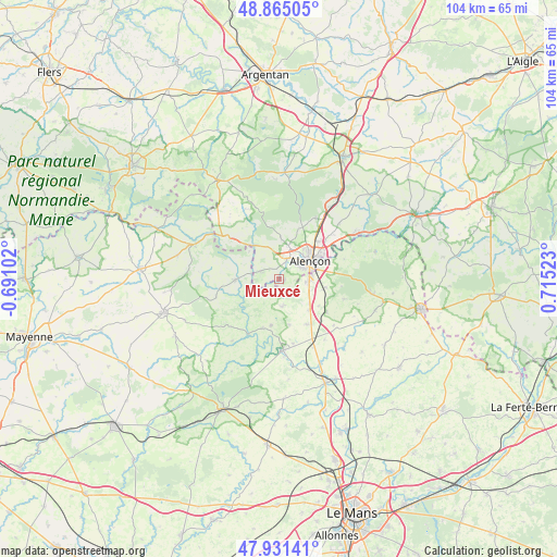
Mieuxcé GPS coordinates[2]
48° 24' 1.332" North, 0° 0' 43.56" East
| Map corner | latitude | longitude |
|---|---|---|
| Upper-left | 48.86505°, | -0.69102° |
| Center: | 48.40037°, | 0.0121° |
| Lower-right: | 47.93141°, | 0.71523° |
| Map W x H: | 103.8×103.8 km | = 64.5×64.5mi |
| max Lat: | 51.07786° ⇑33.6% North |
| Mieuxcé: | 48.40037° |
| min Lat: | ⇓66.4% South 41.3874° |
| min Long | Mieuxcé | max Long |
| -5.08615° | 0.0121° | 9.52242° |
| W 21.9%⇐ | ⇒78.1% E |
Elevation
Elevation of Mieuxcé is 128 m = 420 ft, and this is 65.7 m = 216 ft below average elevation for this country.
| Max E: |
2333 m = 7654 ft | 51.2% |
| Avg. | 193.7 m = 635 ft | |
| Mieuxcé | 128 m = 420 ft | |
Min E: |
-1 m = -3 ft | 48.8% |
See also: France elevation on elevation.city.
Geographical zone
Mieuxcé is located in North temperate zone (between Tropic of Cancer and the Arctic Circle). Distance of this North polar circle is 2019.6 km =1254.9 mi to North.| Distance of | km | miles | from Mieuxcé |
|---|---|---|---|
| North Pole | 4625.4 | 2874.1 | to North |
| Arctic Circle | 2019.6 | 1254.9 | to North |
| Tropic Cancer | 2775.7 | 1724.7 | to South |
| Equator | 5381.6 | 3344 | to South |


Nearby cities:
15 places around Mieuxcé: (largest is in red/bold)
• Alençon
7.1 km =4.4 mi,  57°
57°
• Arçonnay
5.5 km =3.4 mi,  94°
94°
• Condé-sur-Sarthe
3.9 km =2.4 mi,  24°
24°
• Damigny
6.8 km =4.2 mi,  36°
36°
• Gesnes-le-Gandelin
5.1 km =3.2 mi,  174°
174°
• Héloup
1.1 km =0.7 mi,  106°
106°
• La Ferrière-Bochard
3.7 km =2.3 mi,  291°
291°
• Lonrai
6.9 km =4.3 mi, 17°
• Moulins-le-Carbonnel
4 km =2.5 mi,  222°
222°
• Oisseau-le-Petit
8 km =5 mi,  137°
137°
• Saint-Denis-sur-Sarthon
7.3 km =4.5 mi,  323°
323°
• Saint-Germain-du-Corbéis
4.4 km =2.7 mi, 56°
• Saint-Léonard-des-Bois
8.5 km =5.3 mi,  230°
230°
• Saint-Paterne
7.6 km =4.7 mi,  76°
76°
• Saint-Pierre-des-Nids
8.3 km =5.2 mi,  268°
268°
Sources, notices
• [Note1] Compared only with cities in France existing in our database
• [Src1] Map data: © OpenStreetMap contributors (CC-BY-SA)
• [Src2] Other city data from geonames.org with taken over terms of usage.
• [Src3] Geographical zone / Annual Mean Temperature by Robert A. Rohde @ Wikipedia
