Alençon geodata
Alençon (Normandy) is a seat of a second-order administrative division; located in France in Europe/Paris (GMT+2) time zone. With population of 30,786 people, there are 263 cities with bigger population in this country. Compared to other cities in France, 67% of cities are located further ↓South; 77.3% of cities are located further →East and 52.5% of cities have lower elevation than Alençon. Note1
Administrative division(s):
- Level 1: Normandy
- Level 2: Département de l'Orne
- Level 3: Arrondissement d’Alençon
- Level 4: Alençon


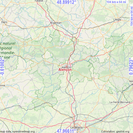
Alençon GPS coordinates[2]
48° 26' 5.136" North, 0° 5' 35.196" East
| Map corner | latitude | longitude |
|---|---|---|
| Upper-left | 48.89912°, | -0.61002° |
| Center: | 48.43476°, | 0.09311° |
| Lower-right: | 47.96611°, | 0.79623° |
| Map W x H: | 103.7×103.7 km | = 64.4×64.4mi |
| max Lat: | 51.07786° ⇑33% North |
| Alençon: | 48.43476° |
| min Lat: | ⇓67% South 41.3874° |
| min Long | Alençon | max Long |
| -5.08615° | 0.09311° | 9.52242° |
| W 22.7%⇐ | ⇒77.3% E |
Elevation
Elevation of Alençon is 141 m = 463 ft, and this is 52.7 m = 173 ft below average elevation for this country.
| Max E: |
2333 m = 7654 ft | 47.5% |
| Avg. | 193.7 m = 635 ft | |
| Alençon | 141 m = 463 ft | |
Min E: |
-1 m = -3 ft | 52.5% |
See also: France elevation on elevation.city.
Geographical zone
Alençon is located in North temperate zone (between Tropic of Cancer and the Arctic Circle). Distance of this North polar circle is 2015.7 km =1252.5 mi to North.| Distance of | km | miles | from Alençon |
|---|---|---|---|
| North Pole | 4621.6 | 2871.7 | to North |
| Arctic Circle | 2015.7 | 1252.5 | to North |
| Tropic Cancer | 2779.5 | 1727.1 | to South |
| Equator | 5385.4 | 3346.3 | to South |


Nearby cities:
15 places around Alençon: (largest is in red/bold)
• Ancinnes
9.7 km =6 mi,  140°
140°
• Arçonnay
4.3 km =2.7 mi,  186°
186°
• Cerisé
3.4 km =2.1 mi,  60°
60°
• Champfleur
6 km =3.7 mi,  153°
153°
• Condé-sur-Sarthe
4.4 km =2.7 mi,  265°
265°
• Damigny
2.6 km =1.6 mi,  310°
310°
• Héloup
6.4 km =4 mi,  229°
229°
• Le Chevain
2.7 km =1.7 mi,  98°
98°
• Lonrai
4.8 km =3 mi, 305°
• Mieuxcé
7.1 km =4.4 mi,  237°
237°
• Oisseau-le-Petit
9.7 km =6 mi,  183°
183°
• Radon
7.6 km =4.7 mi,  5°
5°
• Saint-Germain-du-Corbéis
2.7 km =1.7 mi, 238°
• Saint-Paterne
2.5 km =1.6 mi, 145°
• Valframbert
3.5 km =2.2 mi,  18°
18°
Sources, notices
• [Note1] Compared only with cities in France existing in our database
• [Src1] Map data: © OpenStreetMap contributors (CC-BY-SA)
• [Src2] Other city data from geonames.org with taken over terms of usage.
• [Src3] Geographical zone / Annual Mean Temperature by Robert A. Rohde @ Wikipedia
