Arçonnay geodata
Arçonnay (Pays de la Loire) is a populated place; located in France in Europe/Paris (GMT+2) time zone. With population of 2,166 people, there are 4430 cities with bigger population in this country. Compared to other cities in France, 66.2% of cities are located further ↓South; 77.3% of cities are located further →East and 54.5% of cities have lower elevation than Arçonnay. Note1
Administrative division(s):
- Level 1: Pays de la Loire
- Level 2: Sarthe
- Level 3: Arrondissement de Mamers
- Level 4: Arçonnay


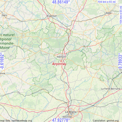
Arçonnay GPS coordinates[2]
48° 23' 48.408" North, 0° 5' 10.32" East
| Map corner | latitude | longitude |
|---|---|---|
| Upper-left | 48.86149°, | -0.61692° |
| Center: | 48.39678°, | 0.0862° |
| Lower-right: | 47.92778°, | 0.78933° |
| Map W x H: | 103.8×103.8 km | = 64.5×64.5mi |
| max Lat: | 51.07786° ⇑33.8% North |
| Arçonnay: | 48.39678° |
| min Lat: | ⇓66.2% South 41.3874° |
| min Long | Arçonnay | max Long |
| -5.08615° | 0.0862° | 9.52242° |
| W 22.7%⇐ | ⇒77.3% E |
Elevation
Elevation of Arçonnay is 148 m = 486 ft, and this is 45.7 m = 150 ft below average elevation for this country.
| Max E: |
2333 m = 7654 ft | 45.5% |
| Avg. | 193.7 m = 635 ft | |
| Arçonnay | 148 m = 486 ft | |
Min E: |
-1 m = -3 ft | 54.5% |
See also: France elevation on elevation.city.
Geographical zone
Arçonnay is located in North temperate zone (between Tropic of Cancer and the Arctic Circle). Distance of this North polar circle is 2020 km =1255.2 mi to North.| Distance of | km | miles | from Arçonnay |
|---|---|---|---|
| North Pole | 4625.8 | 2874.3 | to North |
| Arctic Circle | 2020 | 1255.2 | to North |
| Tropic Cancer | 2775.3 | 1724.5 | to South |
| Equator | 5381.2 | 3343.7 | to South |


Nearby cities:
15 places around Arçonnay: (largest is in red/bold)
• Alençon
4.3 km =2.7 mi,  6°
6°
• Ancinnes
7.5 km =4.7 mi,  116°
116°
• Cerisé
6.9 km =4.3 mi,  30°
30°
• Champfleur
3.4 km =2.1 mi,  109°
109°
• Condé-sur-Sarthe
5.5 km =3.4 mi,  315°
315°
• Damigny
6.1 km =3.8 mi,  346°
346°
• Gesnes-le-Gandelin
6.8 km =4.2 mi,  226°
226°
• Héloup
4.4 km =2.7 mi,  271°
271°
• Le Chevain
5 km =3.1 mi,  39°
39°
• Lonrai
7.8 km =4.8 mi,  334°
334°
• Mieuxcé
5.5 km =3.4 mi, 274°
• Oisseau-le-Petit
5.5 km =3.4 mi,  180°
180°
• Saint-Germain-du-Corbéis
3.3 km =2.1 mi, 327°
• Saint-Paterne
2.9 km =1.8 mi, 42°
• Valframbert
7.7 km =4.8 mi, 12°
Sources, notices
• [Note1] Compared only with cities in France existing in our database
• [Src1] Map data: © OpenStreetMap contributors (CC-BY-SA)
• [Src2] Other city data from geonames.org with taken over terms of usage.
• [Src3] Geographical zone / Annual Mean Temperature by Robert A. Rohde @ Wikipedia
