Hardricourt geodata
Hardricourt (Île-de-France) is a populated place; located in France in Europe/Paris (GMT+2) time zone. With population of 1,941 people, there are 4930 cities with bigger population in this country. Compared to other cities in France, 79.8% of cities are located further ↓South; 58.4% of cities are located further →East and 77.3% of cities have higher elevation than Hardricourt. Note1
Administrative division(s):
- Level 1: Île-de-France
- Level 2: Yvelines
- Level 3: Arrondissement de Mantes-la-Jolie
- Level 4: Hardricourt


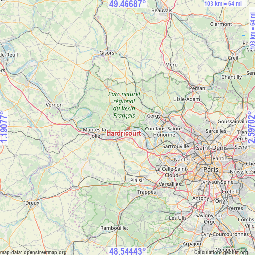
Hardricourt GPS coordinates[2]
49° 0' 28.044" North, 1° 53' 38.004" East
| Map corner | latitude | longitude |
|---|---|---|
| Upper-left | 49.46687°, | 1.19077° |
| Center: | 49.00779°, | 1.89389° |
| Lower-right: | 48.54443°, | 2.59702° |
| Map W x H: | 102.6×102.6 km | = 63.8×63.8mi |
| max Lat: | 51.07786° ⇑20.2% North |
| Hardricourt: | 49.00779° |
| min Lat: | ⇓79.8% South 41.3874° |
| min Long | Hardricourt | max Long |
| -5.08615° | 1.89389° | 9.52242° |
| W 41.6%⇐ | ⇒58.4% E |
Elevation
Elevation of Hardricourt is 61 m = 200 ft, and this is 132.7 m = 435 ft below average elevation for this country.
| Max E: |
2333 m = 7654 ft | 77.3% |
| Avg. | 193.7 m = 635 ft | |
| Hardricourt | 61 m = 200 ft | |
Min E: |
-1 m = -3 ft | 22.7% |
See also: France elevation on elevation.city.
Geographical zone
Hardricourt is located in North temperate zone (between Tropic of Cancer and the Arctic Circle). Distance of this North polar circle is 1952 km =1212.9 mi to North.| Distance of | km | miles | from Hardricourt |
|---|---|---|---|
| North Pole | 4557.9 | 2832.1 | to North |
| Arctic Circle | 1952 | 1212.9 | to North |
| Tropic Cancer | 2843.2 | 1766.7 | to South |
| Equator | 5449.2 | 3386 | to South |


Nearby cities:
15 places around Hardricourt: (largest is in red/bold)
• Bouafle
4.8 km =3 mi,  173°
173°
• Chapet
5.4 km =3.4 mi,  147°
147°
• Condécourt
5 km =3.1 mi,  44°
44°
• Flins-sur-Seine
5 km =3.1 mi,  197°
197°
• Gaillon-sur-Montcient
2.9 km =1.8 mi,  8°
8°
• Jambville
5.2 km =3.2 mi,  324°
324°
• Juziers
3.8 km =2.4 mi,  241°
241°
• Les Mureaux
2.1 km =1.3 mi, 147°
• Meulan-en-Yvelines
0.9 km =0.6 mi,  90°
90°
• Mézy-sur-Seine
1.2 km =0.7 mi,  221°
221°
• Oinville-sur-Montcient
3.9 km =2.4 mi,  303°
303°
• Seraincourt
3.7 km =2.3 mi,  327°
327°
• Tessancourt-sur-Aubette
2.7 km =1.7 mi,  50°
50°
• Vaux-sur-Seine
5.5 km =3.4 mi,  84°
84°
• Évecquemont
3.7 km =2.3 mi, 78°
Sources, notices
• [Note1] Compared only with cities in France existing in our database
• [Src1] Map data: © OpenStreetMap contributors (CC-BY-SA)
• [Src2] Other city data from geonames.org with taken over terms of usage.
• [Src3] Geographical zone / Annual Mean Temperature by Robert A. Rohde @ Wikipedia
