Messery geodata
Messery (Auvergne-Rhône-Alpes) is a populated place; located in France in Europe/Paris (GMT+2) time zone. With population of 1,593 people, there are 5854 cities with bigger population in this country. Compared to other cities in France, 61.7% of cities are located further ↑North; 90.1% of cities are located further ←West and 89.5% of cities have lower elevation than Messery. Note1
Administrative division(s):
- Level 1: Auvergne-Rhône-Alpes
- Level 2: Haute-Savoie
- Level 3: Arrondissement de Thonon-les-Bains
- Level 4: Messery


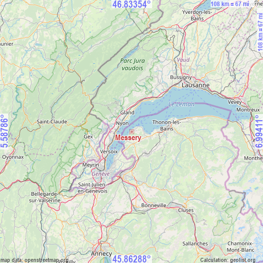
Messery GPS coordinates[2]
46° 21' 1.296" North, 6° 17' 27.564" East
| Map corner | latitude | longitude |
|---|---|---|
| Upper-left | 46.83354°, | 5.58786° |
| Center: | 46.35036°, | 6.29099° |
| Lower-right: | 45.86288°, | 6.99411° |
| Map W x H: | 107.9×107.9 km | = 67×67mi |
| max Lat: | 51.07786° ⇑61.7% North |
| Messery: | 46.35036° |
| min Lat: | ⇓38.3% South 41.3874° |
| min Long | Messery | max Long |
| -5.08615° | 6.29099° | 9.52242° |
| W 90.1%⇐ | ⇒9.9% E |
Elevation
Elevation of Messery is 415 m = 1362 ft, and this is 221.3 m = 726 ft above average elevation for this country.
| Max E: |
2333 m = 7654 ft | 10.5% |
| Messery | 415 m 1362 ft | |
| Avg. | 193.7 m = 635 ft | |
Min E: |
-1 m = -3 ft | 89.5% |
See also: France elevation on elevation.city.
Geographical zone
Messery is located in North temperate zone (between Tropic of Cancer and the Arctic Circle). Distance of this North polar circle is 2247.5 km =1396.5 mi to North.| Distance of | km | miles | from Messery |
|---|---|---|---|
| North Pole | 4853.4 | 3015.8 | to North |
| Arctic Circle | 2247.5 | 1396.5 | to North |
| Tropic Cancer | 2547.8 | 1583.1 | to South |
| Equator | 5153.7 | 3202.4 | to South |


Nearby cities:
15 places around Messery: (largest is in red/bold)
• Anthy-sur-Léman
10.5 km =6.5 mi,  86°
86°
• Ballaison
6.4 km =4 mi,  154°
154°
• Bons-en-Chablais
11.3 km =7 mi, 147°
• Brenthonne
11.9 km =7.4 mi,  136°
136°
• Chens-sur-Léman
3.3 km =2.1 mi,  208°
208°
• Divonne-les-Bains
12 km =7.5 mi,  273°
273°
• Douvaine
5.1 km =3.2 mi,  168°
168°
• Excenevex
4.7 km =2.9 mi, 86°
• Loisin
6.6 km =4.1 mi, 167°
• Machilly
11.5 km =7.1 mi,  163°
163°
• Margencel
9.5 km =5.9 mi,  96°
96°
• Massongy
4.7 km =2.9 mi, 139°
• Sciez
7.4 km =4.6 mi,  105°
105°
• Veigy
9.4 km =5.8 mi,  193°
193°
• Yvoire
3.5 km =2.2 mi,  59°
59°
Sources, notices
• [Note1] Compared only with cities in France existing in our database
• [Src1] Map data: © OpenStreetMap contributors (CC-BY-SA)
• [Src2] Other city data from geonames.org with taken over terms of usage.
• [Src3] Geographical zone / Annual Mean Temperature by Robert A. Rohde @ Wikipedia
