Chens-sur-Léman geodata
Chens-sur-Léman (Auvergne-Rhône-Alpes) is a populated place; located in France in Europe/Paris (GMT+2) time zone. With population of 1,408 people, there are 6574 cities with bigger population in this country. Compared to other cities in France, 62% of cities are located further ↑North; 89.9% of cities are located further ←West and 90% of cities have lower elevation than Chens-sur-Léman. Note1
Administrative division(s):
- Level 1: Auvergne-Rhône-Alpes
- Level 2: Haute-Savoie
- Level 3: Arrondissement de Thonon-les-Bains
- Level 4: Chens-sur-Léman


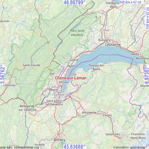
Chens-sur-Léman GPS coordinates[2]
46° 19' 28.524" North, 6° 16' 14.7" East
| Map corner | latitude | longitude |
|---|---|---|
| Upper-left | 46.80799°, | 5.56762° |
| Center: | 46.32459°, | 6.27075° |
| Lower-right: | 45.83688°, | 6.97387° |
| Map W x H: | 108×108 km | = 67.1×67.1mi |
| max Lat: | 51.07786° ⇑62% North |
| Chens-sur-Léman: | 46.32459° |
| min Lat: | ⇓38% South 41.3874° |
| min Long | Chens-sur-Léma | max Long |
| -5.08615° | 6.27075° | 9.52242° |
| W 89.9%⇐ | ⇒10.1% E |
Elevation
Elevation of Chens-sur-Léman is 426 m = 1398 ft, and this is 232.3 m = 762 ft above average elevation for this country.
| Max E: |
2333 m = 7654 ft | 10% |
| Chens-sur-Léman | 426 m 1398 ft | |
| Avg. | 193.7 m = 635 ft | |
Min E: |
-1 m = -3 ft | 90% |
See also: France elevation on elevation.city.
Geographical zone
Chens-sur-Léman is located in North temperate zone (between Tropic of Cancer and the Arctic Circle). Distance of this North polar circle is 2250.4 km =1398.3 mi to North.| Distance of | km | miles | from Chens-sur-Léman |
|---|---|---|---|
| North Pole | 4856.3 | 3017.6 | to North |
| Arctic Circle | 2250.4 | 1398.3 | to North |
| Tropic Cancer | 2544.9 | 1581.3 | to South |
| Equator | 5150.8 | 3200.6 | to South |


Nearby cities:
15 places around Chens-sur-Léman: (largest is in red/bold)
• Ballaison
5.3 km =3.3 mi,  123°
123°
• Bons-en-Chablais
10.2 km =6.3 mi,  130°
130°
• Brenthonne
11.3 km =7 mi, 121°
• Divonne-les-Bains
11 km =6.8 mi,  289°
289°
• Douvaine
3.3 km =2.1 mi, 130°
• Excenevex
7 km =4.3 mi,  63°
63°
• Loisin
4.7 km =2.9 mi,  139°
139°
• Machilly
9.5 km =5.9 mi,  150°
150°
• Margencel
11.2 km =7 mi,  80°
80°
• Massongy
4.7 km =2.9 mi,  98°
98°
• Messery
3.3 km =2.1 mi,  28°
28°
• Saint-Cergues
11.2 km =7 mi,  160°
160°
• Sciez
8.7 km =5.4 mi, 84°
• Veigy
6.3 km =3.9 mi,  185°
185°
• Yvoire
6.5 km =4 mi,  44°
44°
Sources, notices
• [Note1] Compared only with cities in France existing in our database
• [Src1] Map data: © OpenStreetMap contributors (CC-BY-SA)
• [Src2] Other city data from geonames.org with taken over terms of usage.
• [Src3] Geographical zone / Annual Mean Temperature by Robert A. Rohde @ Wikipedia
