Yvoire geodata
Yvoire (Auvergne-Rhône-Alpes) is a populated place; located in France in Europe/Paris (GMT+2) time zone. With population of 707 people, there are 11704 cities with bigger population in this country. Compared to other cities in France, 61.5% of cities are located further ↑North; 90.5% of cities are located further ←West and 89.7% of cities have lower elevation than Yvoire. Note1
Administrative division(s):
- Level 1: Auvergne-Rhône-Alpes
- Level 2: Haute-Savoie
- Level 3: Arrondissement de Thonon-les-Bains
- Level 4: Yvoire


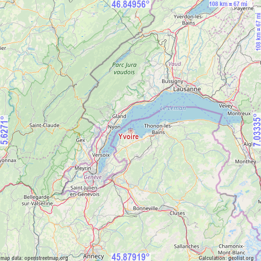
Yvoire GPS coordinates[2]
46° 21' 59.508" North, 6° 19' 48.792" East
| Map corner | latitude | longitude |
|---|---|---|
| Upper-left | 46.84956°, | 5.6271° |
| Center: | 46.36653°, | 6.33022° |
| Lower-right: | 45.87919°, | 7.03335° |
| Map W x H: | 107.9×107.9 km | = 67×67mi |
| max Lat: | 51.07786° ⇑61.5% North |
| Yvoire: | 46.36653° |
| min Lat: | ⇓38.5% South 41.3874° |
| min Long | Yvoire | max Long |
| -5.08615° | 6.33022° | 9.52242° |
| W 90.5%⇐ | ⇒9.5% E |
Elevation
Elevation of Yvoire is 420 m = 1378 ft, and this is 226.3 m = 742 ft above average elevation for this country.
| Max E: |
2333 m = 7654 ft | 10.3% |
| Yvoire | 420 m 1378 ft | |
| Avg. | 193.7 m = 635 ft | |
Min E: |
-1 m = -3 ft | 89.7% |
See also: France elevation on elevation.city.
Geographical zone
Yvoire is located in North temperate zone (between Tropic of Cancer and the Arctic Circle). Distance of this North polar circle is 2245.7 km =1395.4 mi to North.| Distance of | km | miles | from Yvoire |
|---|---|---|---|
| North Pole | 4851.6 | 3014.6 | to North |
| Arctic Circle | 2245.7 | 1395.4 | to North |
| Tropic Cancer | 2549.6 | 1584.2 | to South |
| Equator | 5155.5 | 3203.5 | to South |


Nearby cities:
15 places around Yvoire: (largest is in red/bold)
• Allinges
10.8 km =6.7 mi,  108°
108°
• Anthy-sur-Léman
7.6 km =4.7 mi,  99°
99°
• Ballaison
7.6 km =4.7 mi,  181°
181°
• Brenthonne
11.7 km =7.3 mi,  153°
153°
• Chens-sur-Léman
6.5 km =4 mi,  224°
224°
• Douvaine
7.1 km =4.4 mi,  196°
196°
• Excenevex
2.2 km =1.4 mi,  132°
132°
• Loisin
8.4 km =5.2 mi,  190°
190°
• Lully
11.3 km =7 mi,  143°
143°
• Margencel
7 km =4.3 mi, 113°
• Massongy
5.4 km =3.4 mi, 178°
• Messery
3.5 km =2.2 mi,  239°
239°
• Perrignier
10.8 km =6.7 mi, 128°
• Sciez
5.6 km =3.5 mi, 132°
• Thonon-les-Bains
11.5 km =7.1 mi,  87°
87°
Sources, notices
• [Note1] Compared only with cities in France existing in our database
• [Src1] Map data: © OpenStreetMap contributors (CC-BY-SA)
• [Src2] Other city data from geonames.org with taken over terms of usage.
• [Src3] Geographical zone / Annual Mean Temperature by Robert A. Rohde @ Wikipedia
