Mauves-sur-Loire geodata
Mauves-sur-Loire (Pays de la Loire) is a populated place; located in France in Europe/Paris (GMT+2) time zone. With population of 2,579 people, there are 3787 cities with bigger population in this country. Compared to other cities in France, 51.5% of cities are located further ↑North; 91.4% of cities are located further →East and 81.8% of cities have higher elevation than Mauves-sur-Loire. Note1
Administrative division(s):
- Level 1: Pays de la Loire
- Level 2: Loire-Atlantique
- Level 3: Arrondissement de Nantes
- Level 4: Mauves-sur-Loire


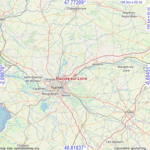
Mauves-sur-Loire GPS coordinates[2]
47° 17' 50.568" North, 1° 23' 15.468" West
| Map corner | latitude | longitude |
|---|---|---|
| Upper-left | 47.77209°, | -2.09076° |
| Center: | 47.29738°, | -1.38763° |
| Lower-right: | 46.81837°, | -0.68451° |
| Map W x H: | 106×106 km | = 65.9×65.9mi |
| max Lat: | 51.07786° ⇑51.5% North |
| Mauves-sur-Loire: | 47.29738° |
| min Lat: | ⇓48.5% South 41.3874° |
| min Long | Mauves-sur-Loir | max Long |
| -5.08615° | -1.38763° | 9.52242° |
| W 8.6%⇐ | ⇒91.4% E |
Elevation
Elevation of Mauves-sur-Loire is 50 m = 164 ft, and this is 143.7 m = 471 ft below average elevation for this country.
| Max E: |
2333 m = 7654 ft | 81.8% |
| Avg. | 193.7 m = 635 ft | |
| Mauves-sur-Loire | 50 m = 164 ft | |
Min E: |
-1 m = -3 ft | 18.2% |
See also: France elevation on elevation.city.
Geographical zone
Mauves-sur-Loire is located in North temperate zone (between Tropic of Cancer and the Arctic Circle). Distance of this North polar circle is 2142.2 km =1331.1 mi to North.| Distance of | km | miles | from Mauves-sur-Loire |
|---|---|---|---|
| North Pole | 4748.1 | 2950.3 | to North |
| Arctic Circle | 2142.2 | 1331.1 | to North |
| Tropic Cancer | 2653.1 | 1648.6 | to South |
| Equator | 5259 | 3267.8 | to South |


Nearby cities:
15 places around Mauves-sur-Loire: (largest is in red/bold)
• Barbechat
8 km =5 mi,  105°
105°
• Basse-Goulaine
11.3 km =7 mi,  212°
212°
• Carquefou
7.7 km =4.8 mi,  270°
270°
• Champtoceaux
10.4 km =6.5 mi,  66°
66°
• Haute-Goulaine
11.4 km =7.1 mi,  196°
196°
• La Chapelle-Basse-Mer
4.7 km =2.9 mi,  128°
128°
• La Varenne
5.3 km =3.3 mi, 73°
• Landemont
11.7 km =7.3 mi, 107°
• Le Cellier
4 km =2.5 mi,  51°
51°
• Le Loroux-Bottereau
7.2 km =4.5 mi,  156°
156°
• Oudon
9.5 km =5.9 mi, 54°
• Saint-Julien-de-Concelles
5 km =3.1 mi,  177°
177°
• Saint-Mars-du-Désert
7.7 km =4.8 mi,  349°
349°
• Sainte-Luce-sur-Loire
8.8 km =5.5 mi,  236°
236°
• Thouaré-sur-Loire
5 km =3.1 mi,  230°
230°
Sources, notices
• [Note1] Compared only with cities in France existing in our database
• [Src1] Map data: © OpenStreetMap contributors (CC-BY-SA)
• [Src2] Other city data from geonames.org with taken over terms of usage.
• [Src3] Geographical zone / Annual Mean Temperature by Robert A. Rohde @ Wikipedia
