Carquefou geodata
Carquefou (Pays de la Loire) is a populated place; located in France in Europe/Paris (GMT+2) time zone. With population of 18,056 people, there are 524 cities with bigger population in this country. Compared to other cities in France, 51.5% of cities are located further ↑North; 92.2% of cities are located further →East and 90.3% of cities have higher elevation than Carquefou. Note1
Administrative division(s):
- Level 1: Pays de la Loire
- Level 2: Loire-Atlantique
- Level 3: Arrondissement de Nantes
- Level 4: Carquefou


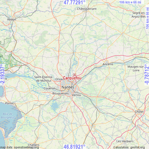
Carquefou GPS coordinates[2]
47° 17' 53.556" North, 1° 29' 24.864" West
| Map corner | latitude | longitude |
|---|---|---|
| Upper-left | 47.77291°, | -2.19337° |
| Center: | 47.29821°, | -1.49024° |
| Lower-right: | 46.81921°, | -0.78712° |
| Map W x H: | 106×106 km | = 65.9×65.9mi |
| max Lat: | 51.07786° ⇑51.5% North |
| Carquefou: | 47.29821° |
| min Lat: | ⇓48.5% South 41.3874° |
| min Long | Carquefou | max Long |
| -5.08615° | -1.49024° | 9.52242° |
| W 7.8%⇐ | ⇒92.2% E |
Elevation
Elevation of Carquefou is 29 m = 95 ft, and this is 164.7 m = 540 ft below average elevation for this country.
| Max E: |
2333 m = 7654 ft | 90.3% |
| Avg. | 193.7 m = 635 ft | |
| Carquefou | 29 m = 95 ft | |
Min E: |
-1 m = -3 ft | 9.7% |
See also: France elevation on elevation.city.
Geographical zone
Carquefou is located in North temperate zone (between Tropic of Cancer and the Arctic Circle). Distance of this North polar circle is 2142.1 km =1331 mi to North.| Distance of | km | miles | from Carquefou |
|---|---|---|---|
| North Pole | 4748 | 2950.3 | to North |
| Arctic Circle | 2142.1 | 1331 | to North |
| Tropic Cancer | 2653.1 | 1648.6 | to South |
| Equator | 5259.1 | 3267.9 | to South |


Nearby cities:
15 places around Carquefou: (largest is in red/bold)
• Basse-Goulaine
9.8 km =6.1 mi,  169°
169°
• Casson
11.1 km =6.9 mi,  333°
333°
• La Chapelle-sur-Erdre
4.7 km =2.9 mi,  266°
266°
• Le Cellier
11.1 km =6.9 mi,  77°
77°
• Mauves-sur-Loire
7.7 km =4.8 mi,  90°
90°
• Nantes
10.2 km =6.3 mi,  207°
207°
• Orvault
10.4 km =6.5 mi,  253°
253°
• Petit-Mars
11.1 km =6.9 mi,  14°
14°
• Saint-Julien-de-Concelles
9.5 km =5.9 mi,  122°
122°
• Saint-Mars-du-Désert
9.8 km =6.1 mi,  40°
40°
• Saint-Sébastien-sur-Loire
10.1 km =6.3 mi,  185°
185°
• Sainte-Luce-sur-Loire
5 km =3.1 mi, 174°
• Sucé-sur-Erdre
5.1 km =3.2 mi,  320°
320°
• Thouaré-sur-Loire
5.1 km =3.2 mi,  129°
129°
• Treillières
10.4 km =6.5 mi,  290°
290°
Sources, notices
• [Note1] Compared only with cities in France existing in our database
• [Src1] Map data: © OpenStreetMap contributors (CC-BY-SA)
• [Src2] Other city data from geonames.org with taken over terms of usage.
• [Src3] Geographical zone / Annual Mean Temperature by Robert A. Rohde @ Wikipedia
