Sainte-Luce-sur-Loire geodata
Sainte-Luce-sur-Loire (Pays de la Loire) is a populated place; located in France in Europe/Paris (GMT+2) time zone. With population of 13,056 people, there are 732 cities with bigger population in this country. Compared to other cities in France, 52.2% of cities are located further ↑North; 92.2% of cities are located further →East and 94.4% of cities have higher elevation than Sainte-Luce-sur-Loire. Note1
Administrative division(s):
- Level 1: Pays de la Loire
- Level 2: Loire-Atlantique
- Level 3: Arrondissement de Nantes
- Level 4: Sainte-Luce-sur-Loire
Current local time in Sainte-Luce-sur-Loire:
05:05 PM, SaturdayDifference from your time zone: hours


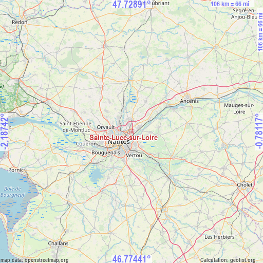
Sainte-Luce-sur-Loire GPS coordinates[2]
47° 15' 13.716" North, 1° 29' 3.48" West
| Map corner | latitude | longitude |
|---|---|---|
| Upper-left | 47.72891°, | -2.18742° |
| Center: | 47.25381°, | -1.4843° |
| Lower-right: | 46.77441°, | -0.78117° |
| Map W x H: | 106.1×106.1 km | = 65.9×65.9mi |
| max Lat: | 51.07786° ⇑52.2% North |
| Sainte-Luce-sur-Loire: | 47.25381° |
| min Lat: | ⇓47.8% South 41.3874° |
| min Long | Sainte-Luce-sur | max Long |
| -5.08615° | -1.4843° | 9.52242° |
| W 7.8%⇐ | ⇒92.2% E |
Elevation
Elevation of Sainte-Luce-sur-Loire is 19 m = 62 ft, and this is 174.7 m = 573 ft below average elevation for this country.
| Max E: |
2333 m = 7654 ft | 94.4% |
| Avg. | 193.7 m = 635 ft | |
| Sainte-Luce-sur-Loire | 19 m = 62 ft | |
Min E: |
-1 m = -3 ft | 5.6% |
See also: France elevation on elevation.city.
Geographical zone
Sainte-Luce-sur-Loire is located in North temperate zone (between Tropic of Cancer and the Arctic Circle). Distance of this North polar circle is 2147 km =1334.1 mi to North.| Distance of | km | miles | from Sainte-Luce-sur-Loire |
|---|---|---|---|
| North Pole | 4752.9 | 2953.3 | to North |
| Arctic Circle | 2147 | 1334.1 | to North |
| Tropic Cancer | 2648.2 | 1645.5 | to South |
| Equator | 5254.1 | 3264.7 | to South |


Nearby cities:
15 places around Sainte-Luce-sur-Loire: (largest is in red/bold)
• Basse-Goulaine
4.9 km =3 mi,  164°
164°
• Carquefou
5 km =3.1 mi,  354°
354°
• Haute-Goulaine
7.4 km =4.6 mi,  145°
145°
• La Chapelle-Basse-Mer
11.1 km =6.9 mi,  80°
80°
• La Chapelle-sur-Erdre
7 km =4.3 mi,  311°
311°
• Le Loroux-Bottereau
10.3 km =6.4 mi,  100°
100°
• Mauves-sur-Loire
8.8 km =5.5 mi,  56°
56°
• Nantes
6.6 km =4.1 mi,  232°
232°
• Orvault
10.6 km =6.6 mi,  280°
280°
• Rezé
9.4 km =5.8 mi,  211°
211°
• Saint-Julien-de-Concelles
7.5 km =4.7 mi,  90°
90°
• Saint-Sébastien-sur-Loire
5.3 km =3.3 mi,  195°
195°
• Sucé-sur-Erdre
9.6 km =6 mi,  337°
337°
• Thouaré-sur-Loire
3.9 km =2.4 mi, 64°
• Vertou
9.5 km =5.9 mi,  173°
173°
Sources, notices
• [Note1] Compared only with cities in France existing in our database
• [Src1] Map data: © OpenStreetMap contributors (CC-BY-SA)
• [Src2] Other city data from geonames.org with taken over terms of usage.
• [Src3] Geographical zone / Annual Mean Temperature by Robert A. Rohde @ Wikipedia
