Saint-Julien-de-Concelles geodata
Saint-Julien-de-Concelles (Pays de la Loire) is a populated place; located in France in Europe/Paris (GMT+2) time zone. With population of 6,758 people, there are 1469 cities with bigger population in this country. Compared to other cities in France, 52.3% of cities are located further ↑North; 91.4% of cities are located further →East and 97% of cities have higher elevation than Saint-Julien-de-Concelles. Note1
Administrative division(s):
- Level 1: Pays de la Loire
- Level 2: Loire-Atlantique
- Level 3: Arrondissement de Nantes
- Level 4: Saint-Julien-de-Concelles
Current local time in Saint-Julien-de-Concelles:
03:00 PM, MondayDifference from your time zone: hours


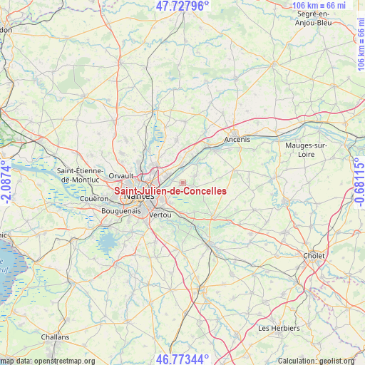
Saint-Julien-de-Concelles GPS coordinates[2]
47° 15' 10.26" North, 1° 23' 3.408" West
| Map corner | latitude | longitude |
|---|---|---|
| Upper-left | 47.72796°, | -2.0874° |
| Center: | 47.25285°, | -1.38428° |
| Lower-right: | 46.77344°, | -0.68115° |
| Map W x H: | 106.1×106.1 km | = 65.9×65.9mi |
| max Lat: | 51.07786° ⇑52.3% North |
| Saint-Julien-de-Concelles: | 47.25285° |
| min Lat: | ⇓47.7% South 41.3874° |
| min Long | Saint-Julien-de | max Long |
| -5.08615° | -1.38428° | 9.52242° |
| W 8.6%⇐ | ⇒91.4% E |
Elevation
Elevation of Saint-Julien-de-Concelles is 11 m = 36 ft, and this is 182.7 m = 599 ft below average elevation for this country.
| Max E: |
2333 m = 7654 ft | 97% |
| Avg. | 193.7 m = 635 ft | |
| Saint-Julien-de-Concelles | 11 m = 36 ft | |
Min E: |
-1 m = -3 ft | 3% |
See also: France elevation on elevation.city.
Geographical zone
Saint-Julien-de-Concelles is located in North temperate zone (between Tropic of Cancer and the Arctic Circle). Distance of this North polar circle is 2147.1 km =1334.1 mi to North.| Distance of | km | miles | from Saint-Julien-de-Concelles |
|---|---|---|---|
| North Pole | 4753 | 2953.4 | to North |
| Arctic Circle | 2147.1 | 1334.1 | to North |
| Tropic Cancer | 2648.1 | 1645.5 | to South |
| Equator | 5254 | 3264.7 | to South |


Nearby cities:
15 places around Saint-Julien-de-Concelles: (largest is in red/bold)
• Barbechat
8 km =5 mi,  69°
69°
• Basse-Goulaine
7.8 km =4.8 mi,  233°
233°
• Carquefou
9.5 km =5.9 mi,  302°
302°
• Haute-Goulaine
6.9 km =4.3 mi,  209°
209°
• La Chapelle-Basse-Mer
4 km =2.5 mi,  59°
59°
• La Chapelle-Heulin
9.1 km =5.7 mi,  158°
158°
• La Remaudière
10.8 km =6.7 mi,  99°
99°
• La Varenne
8.1 km =5 mi,  36°
36°
• Le Cellier
8 km =5 mi,  21°
21°
• Le Landreau
8 km =5 mi,  131°
131°
• Le Loroux-Bottereau
3.1 km =1.9 mi,  122°
122°
• Mauves-sur-Loire
5 km =3.1 mi,  357°
357°
• Saint-Sébastien-sur-Loire
10.3 km =6.4 mi,  240°
240°
• Sainte-Luce-sur-Loire
7.5 km =4.7 mi,  270°
270°
• Thouaré-sur-Loire
4.5 km =2.8 mi,  293°
293°
Sources, notices
• [Note1] Compared only with cities in France existing in our database
• [Src1] Map data: © OpenStreetMap contributors (CC-BY-SA)
• [Src2] Other city data from geonames.org with taken over terms of usage.
• [Src3] Geographical zone / Annual Mean Temperature by Robert A. Rohde @ Wikipedia
