Gotein-Libarrenx geodata
Gotein-Libarrenx (Nouvelle-Aquitaine) is a populated place; located in France in Europe/Paris (GMT+2) time zone. With population of 505 people, there are 15148 cities with bigger population in this country. Compared to other cities in France, 97.2% of cities are located further ↑North; 87.4% of cities are located further →East and 62.5% of cities have lower elevation than Gotein-Libarrenx. Note1
Administrative division(s):
- Level 1: Nouvelle-Aquitaine
- Level 2: Département des Pyrénées-Atlantiques
- Level 3: Oloron-Sainte-Marie
- Level 4: Gotein-Libarrenx


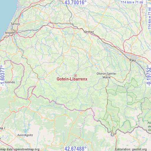
Gotein-Libarrenx GPS coordinates[2]
43° 11' 22.812" North, 0° 54' 2.304" West
| Map corner | latitude | longitude |
|---|---|---|
| Upper-left | 43.70016°, | -1.60377° |
| Center: | 43.18967°, | -0.90064° |
| Lower-right: | 42.67488°, | -0.19752° |
| Map W x H: | 114×114 km | = 70.8×70.8mi |
| max Lat: | 51.07786° ⇑97.2% North |
| Gotein-Libarrenx: | 43.18967° |
| min Lat: | ⇓2.8% South 41.3874° |
| min Long | Gotein-Libarren | max Long |
| -5.08615° | -0.90064° | 9.52242° |
| W 12.6%⇐ | ⇒87.4% E |
Elevation
Elevation of Gotein-Libarrenx is 182 m = 597 ft, and this is 11.7 m = 38 ft below average elevation for this country.
| Max E: |
2333 m = 7654 ft | 37.5% |
| Avg. | 193.7 m = 635 ft | |
| Gotein-Libarrenx | 182 m = 597 ft | |
Min E: |
-1 m = -3 ft | 62.5% |
See also: France elevation on elevation.city.
Geographical zone
Gotein-Libarrenx is located in North temperate zone (between Tropic of Cancer and the Arctic Circle). Distance of this Northern Tropic circle is 2196.3 km =1364.7 mi to South.| Distance of | km | miles | from Gotein-Libarrenx |
|---|---|---|---|
| North Pole | 5204.8 | 3234.1 | to North |
| Arctic Circle | 2598.9 | 1614.9 | to North |
| Tropic Cancer | 2196.3 | 1364.7 | to South |
| Equator | 4802.2 | 2983.9 | to South |


Nearby cities:
15 places around Gotein-Libarrenx: (largest is in red/bold)
• Aramits
17 km =10.6 mi,  118°
118°
• Arette
17.9 km =11.1 mi, 123°
• Aïcirits-Camou-Suhast
19.1 km =11.9 mi,  328°
328°
• Barcus
10.6 km =6.6 mi,  90°
90°
• Chéraute
5.3 km =3.3 mi,  29°
29°
• Espès-Undurein
8.7 km =5.4 mi,  9°
9°
• Esquiule
15 km =9.3 mi, 85°
• Garindein
2.2 km =1.4 mi,  349°
349°
• Mauléon-Licharre
4.4 km =2.7 mi,  21°
21°
• Moumour
19.2 km =11.9 mi,  81°
81°
• Navarrenx
18.6 km =11.6 mi,  38°
38°
• Ordiarp
3.6 km =2.2 mi,  264°
264°
• Saint-Palais
18.8 km =11.7 mi, 325°
• Tardets-Sorholus
8.5 km =5.3 mi,  159°
159°
• Viodos-Abense-de-Bas
6 km =3.7 mi, 15°
In other languages:
- In France: Gotein, Gotein-Libarrenx
- In Russian: Готен-Либарренс
- In Chinese: 戈坦利巴朗
Sources, notices
• [Note1] Compared only with cities in France existing in our database
• [Src1] Map data: © OpenStreetMap contributors (CC-BY-SA)
• [Src2] Other city data from geonames.org with taken over terms of usage.
• [Src3] Geographical zone / Annual Mean Temperature by Robert A. Rohde @ Wikipedia
