Marquion geodata
Marquion (Hauts-de-France) is a populated place; located in France in Europe/Paris (GMT+2) time zone. With population of 1,035 people, there are 8575 cities with bigger population in this country. Compared to other cities in France, 94.9% of cities are located further ↓South; 59.1% of cities are located further ←West and 81.1% of cities have higher elevation than Marquion. Note1
Administrative division(s):
- Level 1: Hauts-de-France
- Level 2: Pas-de-Calais
- Level 3: Arras
- Level 4: Marquion


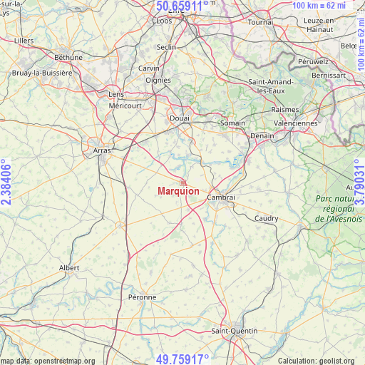
Marquion GPS coordinates[2]
50° 12' 40.536" North, 3° 5' 13.884" East
| Map corner | latitude | longitude |
|---|---|---|
| Upper-left | 50.65911°, | 2.38406° |
| Center: | 50.21126°, | 3.08719° |
| Lower-right: | 49.75917°, | 3.79031° |
| Map W x H: | 100.1×100.1 km | = 62.2×62.2mi |
| max Lat: | 51.07786° ⇑5.1% North |
| Marquion: | 50.21126° |
| min Lat: | ⇓94.9% South 41.3874° |
| min Long | Marquion | max Long |
| -5.08615° | 3.08719° | 9.52242° |
| W 59.1%⇐ | ⇒40.9% E |
Elevation
Elevation of Marquion is 52 m = 171 ft, and this is 141.7 m = 465 ft below average elevation for this country.
| Max E: |
2333 m = 7654 ft | 81.1% |
| Avg. | 193.7 m = 635 ft | |
| Marquion | 52 m = 171 ft | |
Min E: |
-1 m = -3 ft | 18.9% |
See also: France elevation on elevation.city.
Geographical zone
Marquion is located in North temperate zone (between Tropic of Cancer and the Arctic Circle). Distance of this North polar circle is 1818.2 km =1129.8 mi to North.| Distance of | km | miles | from Marquion |
|---|---|---|---|
| North Pole | 4424.1 | 2749 | to North |
| Arctic Circle | 1818.2 | 1129.8 | to North |
| Tropic Cancer | 2977 | 1849.8 | to South |
| Equator | 5583 | 3469.1 | to South |


Nearby cities:
15 places around Marquion: (largest is in red/bold)
• Arleux
7.8 km =4.8 mi,  9°
9°
• Aubencheul-au-Bac
7.1 km =4.4 mi,  44°
44°
• Aubigny-au-Bac
8 km =5 mi, 43°
• Bourlon
4.3 km =2.7 mi,  153°
153°
• Fontaine-Notre-Dame
7.1 km =4.4 mi,  134°
134°
• Graincourt-lès-Havrincourt
7.3 km =4.5 mi,  167°
167°
• Hamel
7.6 km =4.7 mi,  353°
353°
• Haynecourt
5.1 km =3.2 mi,  93°
93°
• Inchy-en-Artois
4.2 km =2.6 mi,  215°
215°
• Lécluse
8 km =5 mi,  335°
335°
• Oisy-le-Verger
5.1 km =3.2 mi,  30°
30°
• Palluel
5.6 km =3.5 mi,  3°
3°
• Raillencourt-Sainte-Olle
6.5 km =4 mi,  118°
118°
• Rumaucourt
4 km =2.5 mi,  331°
331°
• Écourt-Saint-Quentin
4.7 km =2.9 mi, 347°
Sources, notices
• [Note1] Compared only with cities in France existing in our database
• [Src1] Map data: © OpenStreetMap contributors (CC-BY-SA)
• [Src2] Other city data from geonames.org with taken over terms of usage.
• [Src3] Geographical zone / Annual Mean Temperature by Robert A. Rohde @ Wikipedia
