Fontaine-Notre-Dame geodata
Fontaine-Notre-Dame (Hauts-de-France) is a populated place; located in France in Europe/Paris (GMT+2) time zone. With population of 1,693 people, there are 5542 cities with bigger population in this country. Compared to other cities in France, 94.7% of cities are located further ↓South; 60% of cities are located further ←West and 73.1% of cities have higher elevation than Fontaine-Notre-Dame. Note1
Administrative division(s):
- Level 1: Hauts-de-France
- Level 2: Nord
- Level 3: Arrondissement de Cambrai
- Level 4: Fontaine-Notre-Dame


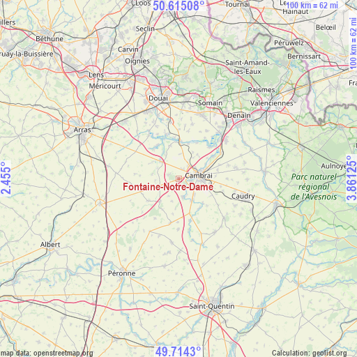
Fontaine-Notre-Dame GPS coordinates[2]
50° 10' 0.516" North, 3° 9' 29.232" East
| Map corner | latitude | longitude |
|---|---|---|
| Upper-left | 50.61508°, | 2.455° |
| Center: | 50.16681°, | 3.15812° |
| Lower-right: | 49.7143°, | 3.86125° |
| Map W x H: | 100.2×100.2 km | = 62.3×62.3mi |
| max Lat: | 51.07786° ⇑5.3% North |
| Fontaine-Notre-Dame: | 50.16681° |
| min Lat: | ⇓94.7% South 41.3874° |
| min Long | Fontaine-Notre- | max Long |
| -5.08615° | 3.15812° | 9.52242° |
| W 60%⇐ | ⇒40% E |
Elevation
Elevation of Fontaine-Notre-Dame is 71 m = 233 ft, and this is 122.7 m = 403 ft below average elevation for this country.
| Max E: |
2333 m = 7654 ft | 73.1% |
| Avg. | 193.7 m = 635 ft | |
| Fontaine-Notre-Dame | 71 m = 233 ft | |
Min E: |
-1 m = -3 ft | 26.9% |
See also: France elevation on elevation.city.
Geographical zone
Fontaine-Notre-Dame is located in North temperate zone (between Tropic of Cancer and the Arctic Circle). Distance of this North polar circle is 1823.1 km =1132.8 mi to North.| Distance of | km | miles | from Fontaine-Notre-Dame |
|---|---|---|---|
| North Pole | 4429 | 2752.1 | to North |
| Arctic Circle | 1823.1 | 1132.8 | to North |
| Tropic Cancer | 2972.1 | 1846.8 | to South |
| Equator | 5578 | 3466 | to South |


Nearby cities:
15 places around Fontaine-Notre-Dame: (largest is in red/bold)
• Bourlon
3.3 km =2.1 mi,  289°
289°
• Cambrai
5.5 km =3.4 mi,  79°
79°
• Graincourt-lès-Havrincourt
4.1 km =2.5 mi,  238°
238°
• Haynecourt
4.6 km =2.9 mi,  0°
0°
• Inchy-en-Artois
7.7 km =4.8 mi,  281°
281°
• Marcoing
5.2 km =3.2 mi,  168°
168°
• Marquion
7.1 km =4.4 mi,  314°
314°
• Masnières
6.8 km =4.2 mi,  147°
147°
• Neuville-Saint-Rémy
5.2 km =3.2 mi,  65°
65°
• Niergnies
7.3 km =4.5 mi,  107°
107°
• Noyelles-sur-Escaut
4.1 km =2.5 mi, 154°
• Proville
3.5 km =2.2 mi,  99°
99°
• Raillencourt-Sainte-Olle
1.9 km =1.2 mi,  18°
18°
• Rumilly-en-Cambrésis
6.2 km =3.9 mi,  135°
135°
• Tilloy-lez-Cambrai
5.6 km =3.5 mi,  48°
48°
Sources, notices
• [Note1] Compared only with cities in France existing in our database
• [Src1] Map data: © OpenStreetMap contributors (CC-BY-SA)
• [Src2] Other city data from geonames.org with taken over terms of usage.
• [Src3] Geographical zone / Annual Mean Temperature by Robert A. Rohde @ Wikipedia
