Bourlon geodata
Bourlon (Hauts-de-France) is a populated place; located in France in Europe/Paris (GMT+2) time zone. With population of 1,276 people, there are 7143 cities with bigger population in this country. Compared to other cities in France, 94.7% of cities are located further ↓South; 59.5% of cities are located further ←West and 69.2% of cities have higher elevation than Bourlon. Note1
Administrative division(s):
- Level 1: Hauts-de-France
- Level 2: Pas-de-Calais
- Level 3: Arras
- Level 4: Bourlon


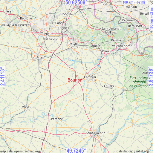
Bourlon GPS coordinates[2]
50° 10' 36.912" North, 3° 6' 51.3" East
| Map corner | latitude | longitude |
|---|---|---|
| Upper-left | 50.62509°, | 2.41113° |
| Center: | 50.17692°, | 3.11425° |
| Lower-right: | 49.7245°, | 3.81738° |
| Map W x H: | 100.1×100.1 km | = 62.2×62.2mi |
| max Lat: | 51.07786° ⇑5.3% North |
| Bourlon: | 50.17692° |
| min Lat: | ⇓94.7% South 41.3874° |
| min Long | Bourlon | max Long |
| -5.08615° | 3.11425° | 9.52242° |
| W 59.5%⇐ | ⇒40.5% E |
Elevation
Elevation of Bourlon is 80 m = 262 ft, and this is 113.7 m = 373 ft below average elevation for this country.
| Max E: |
2333 m = 7654 ft | 69.2% |
| Avg. | 193.7 m = 635 ft | |
| Bourlon | 80 m = 262 ft | |
Min E: |
-1 m = -3 ft | 30.8% |
See also: France elevation on elevation.city.
Geographical zone
Bourlon is located in North temperate zone (between Tropic of Cancer and the Arctic Circle). Distance of this North polar circle is 1822 km =1132.1 mi to North.| Distance of | km | miles | from Bourlon |
|---|---|---|---|
| North Pole | 4427.9 | 2751.4 | to North |
| Arctic Circle | 1822 | 1132.1 | to North |
| Tropic Cancer | 2973.2 | 1847.5 | to South |
| Equator | 5579.2 | 3466.8 | to South |


Nearby cities:
15 places around Bourlon: (largest is in red/bold)
• Cambrai
8.6 km =5.3 mi,  90°
90°
• Fontaine-Notre-Dame
3.3 km =2.1 mi,  109°
109°
• Graincourt-lès-Havrincourt
3.3 km =2.1 mi,  186°
186°
• Haynecourt
4.8 km =3 mi,  42°
42°
• Hermies
8.9 km =5.5 mi,  215°
215°
• Inchy-en-Artois
4.4 km =2.7 mi,  275°
275°
• Marcoing
7.5 km =4.7 mi,  145°
145°
• Marquion
4.3 km =2.7 mi,  333°
333°
• Neuville-Saint-Rémy
7.9 km =4.9 mi,  82°
82°
• Noyelles-sur-Escaut
6.9 km =4.3 mi,  134°
134°
• Oisy-le-Verger
8.2 km =5.1 mi,  4°
4°
• Proville
6.8 km =4.2 mi,  104°
104°
• Raillencourt-Sainte-Olle
3.8 km =2.4 mi, 79°
• Rumaucourt
8.3 km =5.2 mi, 332°
• Tilloy-lez-Cambrai
7.7 km =4.8 mi,  70°
70°
Sources, notices
• [Note1] Compared only with cities in France existing in our database
• [Src1] Map data: © OpenStreetMap contributors (CC-BY-SA)
• [Src2] Other city data from geonames.org with taken over terms of usage.
• [Src3] Geographical zone / Annual Mean Temperature by Robert A. Rohde @ Wikipedia
