Marcellaz geodata
Marcellaz (Auvergne-Rhône-Alpes) is a populated place; located in France in Europe/Paris (GMT+2) time zone. With population of 770 people, there are 10937 cities with bigger population in this country. Compared to other cities in France, 64.4% of cities are located further ↑North; 90.7% of cities are located further ←West and 96.2% of cities have lower elevation than Marcellaz. Note1
Administrative division(s):
- Level 1: Auvergne-Rhône-Alpes
- Level 2: Haute-Savoie
- Level 3: Arrondissement de Bonneville
- Level 4: Marcellaz


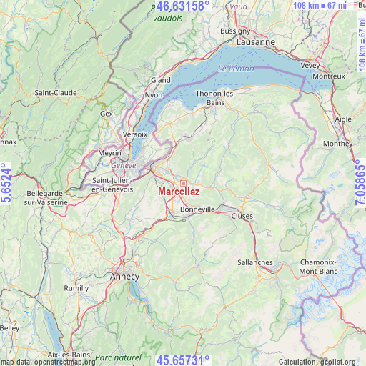
Marcellaz GPS coordinates[2]
46° 8' 47.76" North, 6° 21' 19.872" East
| Map corner | latitude | longitude |
|---|---|---|
| Upper-left | 46.63158°, | 5.6524° |
| Center: | 46.1466°, | 6.35552° |
| Lower-right: | 45.65731°, | 7.05865° |
| Map W x H: | 108.3×108.3 km | = 67.3×67.3mi |
| max Lat: | 51.07786° ⇑64.4% North |
| Marcellaz: | 46.1466° |
| min Lat: | ⇓35.6% South 41.3874° |
| min Long | Marcellaz | max Long |
| -5.08615° | 6.35552° | 9.52242° |
| W 90.7%⇐ | ⇒9.3% E |
Elevation
Elevation of Marcellaz is 657 m = 2156 ft, and this is 463.3 m = 1520 ft above average elevation for this country.
| Max E: |
2333 m = 7654 ft | 3.8% |
| Marcellaz | 657 m 2156 ft | |
| Avg. | 193.7 m = 635 ft | |
Min E: |
-1 m = -3 ft | 96.2% |
See also: France elevation on elevation.city.
Geographical zone
Marcellaz is located in North temperate zone (between Tropic of Cancer and the Arctic Circle). Distance of this North polar circle is 2270.2 km =1410.6 mi to North.| Distance of | km | miles | from Marcellaz |
|---|---|---|---|
| North Pole | 4876 | 3029.8 | to North |
| Arctic Circle | 2270.2 | 1410.6 | to North |
| Tropic Cancer | 2525.1 | 1569 | to South |
| Equator | 5131 | 3188.3 | to South |


Nearby cities:
15 places around Marcellaz: (largest is in red/bold)
• Arenthon
4.7 km =2.9 mi,  201°
201°
• Bonne
3.7 km =2.3 mi,  319°
319°
• Contamine-sur-Arve
1.9 km =1.2 mi,  254°
254°
• Cranves-Sales
6.3 km =3.9 mi, 316°
• Fillinges
1.8 km =1.1 mi, 324°
• La Tour
6 km =3.7 mi,  104°
104°
• Lucinges
5.9 km =3.7 mi,  328°
328°
• Nangy
3.9 km =2.4 mi,  283°
283°
• Peillonnex
2.6 km =1.6 mi,  140°
140°
• Reignier-Ésery
7 km =4.3 mi,  257°
257°
• Saint-André-de-Boëge
5.5 km =3.4 mi,  31°
31°
• Saint-Jean-de-Tholome
4.8 km =3 mi, 141°
• Scientrier
4.2 km =2.6 mi,  214°
214°
• Ville-en-Sallaz
5.1 km =3.2 mi,  92°
92°
• Viuz-en-Sallaz
4 km =2.5 mi, 89°
Sources, notices
• [Note1] Compared only with cities in France existing in our database
• [Src1] Map data: © OpenStreetMap contributors (CC-BY-SA)
• [Src2] Other city data from geonames.org with taken over terms of usage.
• [Src3] Geographical zone / Annual Mean Temperature by Robert A. Rohde @ Wikipedia
