Fontaine-la-Gaillarde geodata
Fontaine-la-Gaillarde (Bourgogne-Franche-Comté) is a populated place; located in France in Europe/Paris (GMT+2) time zone. With population of 506 people, there are 15128 cities with bigger population in this country. Compared to other cities in France, 63.2% of cities are located further ↓South; 63% of cities are located further ←West and 53.1% of cities have higher elevation than Fontaine-la-Gaillarde. Note1
Administrative division(s):
- Level 1: Bourgogne-Franche-Comté
- Level 2: Département de l'Yonne
- Level 3: Arrondissement de Sens
- Level 4: Fontaine-la-Gaillarde
Current local time in Fontaine-la-Gaillarde:
04:54 AM, WednesdayDifference from your time zone: hours


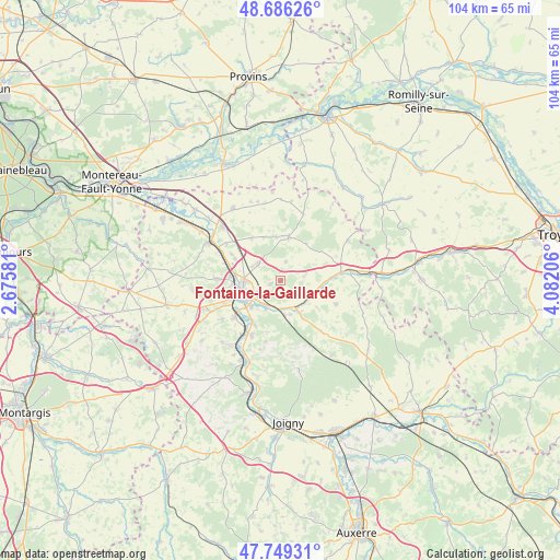
Fontaine-la-Gaillarde GPS coordinates[2]
48° 13' 11.748" North, 3° 22' 44.148" East
| Map corner | latitude | longitude |
|---|---|---|
| Upper-left | 48.68626°, | 2.67581° |
| Center: | 48.21993°, | 3.37893° |
| Lower-right: | 47.74931°, | 4.08206° |
| Map W x H: | 104.2×104.2 km | = 64.7×64.7mi |
| max Lat: | 51.07786° ⇑36.8% North |
| Fontaine-la-Gaillarde: | 48.21993° |
| min Lat: | ⇓63.2% South 41.3874° |
| min Long | Fontaine-la-Gai | max Long |
| -5.08615° | 3.37893° | 9.52242° |
| W 63%⇐ | ⇒37% E |
Elevation
Elevation of Fontaine-la-Gaillarde is 122 m = 400 ft, and this is 71.7 m = 235 ft below average elevation for this country.
| Max E: |
2333 m = 7654 ft | 53.1% |
| Avg. | 193.7 m = 635 ft | |
| Fontaine-la-Gaillarde | 122 m = 400 ft | |
Min E: |
-1 m = -3 ft | 46.9% |
See also: France elevation on elevation.city.
Geographical zone
Fontaine-la-Gaillarde is located in North temperate zone (between Tropic of Cancer and the Arctic Circle). Distance of this North polar circle is 2039.6 km =1267.3 mi to North.| Distance of | km | miles | from Fontaine-la-Gaillarde |
|---|---|---|---|
| North Pole | 4645.5 | 2886.6 | to North |
| Arctic Circle | 2039.6 | 1267.3 | to North |
| Tropic Cancer | 2755.6 | 1712.2 | to South |
| Equator | 5361.6 | 3331.5 | to South |


Nearby cities:
15 places around Fontaine-la-Gaillarde: (largest is in red/bold)
• Courtois-sur-Yonne
9.2 km =5.7 mi,  274°
274°
• Cuy
9.3 km =5.8 mi,  296°
296°
• Gron
10.9 km =6.8 mi,  231°
231°
• Maillot
7.2 km =4.5 mi, 226°
• Malay-le-Grand
5.6 km =3.5 mi,  209°
209°
• Paron
10.5 km =6.5 mi,  244°
244°
• Saint-Clément
6.1 km =3.8 mi, 267°
• Saint-Denis-lès-Sens
8.4 km =5.2 mi,  276°
276°
• Saint-Martin-du-Tertre
8.7 km =5.4 mi, 267°
• Saligny
2.1 km =1.3 mi,  251°
251°
• Sens
7.5 km =4.7 mi, 250°
• Soucy
5.2 km =3.2 mi,  308°
308°
• Theil-sur-Vanne
6.9 km =4.3 mi,  149°
149°
• Thorigny-sur-Oreuse
8.3 km =5.2 mi,  11°
11°
• Étigny
11 km =6.8 mi,  215°
215°
Sources, notices
• [Note1] Compared only with cities in France existing in our database
• [Src1] Map data: © OpenStreetMap contributors (CC-BY-SA)
• [Src2] Other city data from geonames.org with taken over terms of usage.
• [Src3] Geographical zone / Annual Mean Temperature by Robert A. Rohde @ Wikipedia
