Soucy geodata
Soucy (Bourgogne-Franche-Comté) is a populated place; located in France in Europe/Paris (GMT+2) time zone. With population of 1,415 people, there are 6540 cities with bigger population in this country. Compared to other cities in France, 63.7% of cities are located further ↓South; 62.3% of cities are located further ←West and 63.2% of cities have higher elevation than Soucy. Note1
Administrative division(s):
- Level 1: Bourgogne-Franche-Comté
- Level 2: Département de l'Yonne
- Level 3: Arrondissement de Sens
- Level 4: Soucy


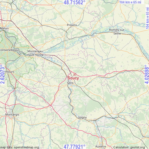
Soucy GPS coordinates[2]
48° 14' 58.416" North, 3° 19' 25.86" East
| Map corner | latitude | longitude |
|---|---|---|
| Upper-left | 48.71562°, | 2.62073° |
| Center: | 48.24956°, | 3.32385° |
| Lower-right: | 47.77921°, | 4.02698° |
| Map W x H: | 104.1×104.1 km | = 64.7×64.7mi |
| max Lat: | 51.07786° ⇑36.3% North |
| Soucy: | 48.24956° |
| min Lat: | ⇓63.7% South 41.3874° |
| min Long | Soucy | max Long |
| -5.08615° | 3.32385° | 9.52242° |
| W 62.3%⇐ | ⇒37.7% E |
Elevation
Elevation of Soucy is 94 m = 308 ft, and this is 99.7 m = 327 ft below average elevation for this country.
| Max E: |
2333 m = 7654 ft | 63.2% |
| Avg. | 193.7 m = 635 ft | |
| Soucy | 94 m = 308 ft | |
Min E: |
-1 m = -3 ft | 36.8% |
See also: France elevation on elevation.city.
Geographical zone
Soucy is located in North temperate zone (between Tropic of Cancer and the Arctic Circle). Distance of this North polar circle is 2036.3 km =1265.3 mi to North.| Distance of | km | miles | from Soucy |
|---|---|---|---|
| North Pole | 4642.2 | 2884.5 | to North |
| Arctic Circle | 2036.3 | 1265.3 | to North |
| Tropic Cancer | 2758.9 | 1714.3 | to South |
| Equator | 5364.8 | 3333.5 | to South |


Nearby cities:
15 places around Soucy: (largest is in red/bold)
• Courtois-sur-Yonne
5.7 km =3.5 mi,  243°
243°
• Cuy
4.4 km =2.7 mi,  281°
281°
• Fontaine-la-Gaillarde
5.2 km =3.2 mi,  128°
128°
• Gisy-les-Nobles
7 km =4.3 mi,  301°
301°
• Maillot
8.3 km =5.2 mi,  188°
188°
• Malay-le-Grand
8.3 km =5.2 mi,  170°
170°
• Michery
9.5 km =5.9 mi,  314°
314°
• Paron
9.5 km =5.9 mi,  214°
214°
• Pont-sur-Yonne
9.8 km =6.1 mi,  292°
292°
• Saint-Clément
4.1 km =2.5 mi, 209°
• Saint-Denis-lès-Sens
4.9 km =3 mi, 240°
• Saint-Martin-du-Tertre
5.9 km =3.7 mi,  231°
231°
• Saligny
4.5 km =2.8 mi,  152°
152°
• Sens
6.5 km =4 mi, 207°
• Thorigny-sur-Oreuse
7.5 km =4.7 mi,  49°
49°
Sources, notices
• [Note1] Compared only with cities in France existing in our database
• [Src1] Map data: © OpenStreetMap contributors (CC-BY-SA)
• [Src2] Other city data from geonames.org with taken over terms of usage.
• [Src3] Geographical zone / Annual Mean Temperature by Robert A. Rohde @ Wikipedia
