Esclavolles-Lurey geodata
Esclavolles-Lurey (Grand Est) is a populated place; located in France in Europe/Paris (GMT+2) time zone. With population of 564 people, there are 13934 cities with bigger population in this country. Compared to other cities in France, 69.6% of cities are located further ↓South; 65.4% of cities are located further ←West and 74.1% of cities have higher elevation than Esclavolles-Lurey. Note1
Administrative division(s):
- Level 1: Grand Est
- Level 2: Marne
- Level 3: Arrondissement d'Épernay
- Level 4: Esclavolles-Lurey


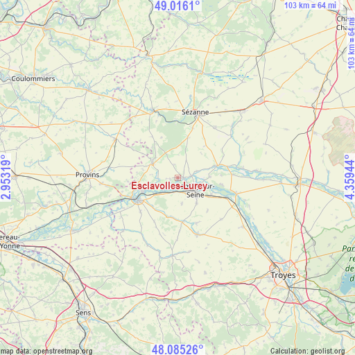
Esclavolles-Lurey GPS coordinates[2]
48° 33' 10.152" North, 3° 39' 22.752" East
| Map corner | latitude | longitude |
|---|---|---|
| Upper-left | 49.0161°, | 2.95319° |
| Center: | 48.55282°, | 3.65632° |
| Lower-right: | 48.08526°, | 4.35944° |
| Map W x H: | 103.5×103.5 km | = 64.3×64.3mi |
| max Lat: | 51.07786° ⇑30.4% North |
| Esclavolles-Lurey: | 48.55282° |
| min Lat: | ⇓69.6% South 41.3874° |
| min Long | Esclavolles-Lur | max Long |
| -5.08615° | 3.65632° | 9.52242° |
| W 65.4%⇐ | ⇒34.6% E |
Elevation
Elevation of Esclavolles-Lurey is 69 m = 226 ft, and this is 124.7 m = 409 ft below average elevation for this country.
| Max E: |
2333 m = 7654 ft | 74.1% |
| Avg. | 193.7 m = 635 ft | |
| Esclavolles-Lurey | 69 m = 226 ft | |
Min E: |
-1 m = -3 ft | 25.9% |
See also: France elevation on elevation.city.
Geographical zone
Esclavolles-Lurey is located in North temperate zone (between Tropic of Cancer and the Arctic Circle). Distance of this North polar circle is 2002.6 km =1244.4 mi to North.| Distance of | km | miles | from Esclavolles-Lurey |
|---|---|---|---|
| North Pole | 4608.5 | 2863.6 | to North |
| Arctic Circle | 2002.6 | 1244.4 | to North |
| Tropic Cancer | 2792.6 | 1735.2 | to South |
| Equator | 5398.6 | 3354.5 | to South |


Nearby cities:
15 places around Esclavolles-Lurey: (largest is in red/bold)
• Anglure
12.2 km =7.6 mi,  72°
72°
• Barbonne-Fayel
11.8 km =7.3 mi,  13°
13°
• Clesles
13.1 km =8.1 mi,  99°
99°
• Conflans-sur-Seine
1.8 km =1.1 mi,  91°
91°
• Crancey
4.2 km =2.6 mi,  197°
197°
• Gélannes
7.7 km =4.8 mi,  170°
170°
• Maizières-la-Grande-Paroisse
10.6 km =6.6 mi,  116°
116°
• Marcilly-sur-Seine
3.9 km =2.4 mi,  82°
82°
• Origny-le-Sec
13 km =8.1 mi,  138°
138°
• Pars-lès-Romilly
9.2 km =5.7 mi, 143°
• Pont-sur-Seine
5.9 km =3.7 mi,  228°
228°
• Romilly-sur-Seine
7 km =4.3 mi,  132°
132°
• Saint-Aubin
11.2 km =7 mi,  220°
220°
• Saint-Just-Sauvage
9.4 km =5.8 mi, 88°
• Villenauxe-la-Grande
8.5 km =5.3 mi,  293°
293°
Sources, notices
• [Note1] Compared only with cities in France existing in our database
• [Src1] Map data: © OpenStreetMap contributors (CC-BY-SA)
• [Src2] Other city data from geonames.org with taken over terms of usage.
• [Src3] Geographical zone / Annual Mean Temperature by Robert A. Rohde @ Wikipedia
