Loyettes geodata
Loyettes (Auvergne-Rhône-Alpes) is a populated place; located in France in Europe/Paris (GMT+2) time zone. With population of 2,541 people, there are 3840 cities with bigger population in this country. Compared to other cities in France, 69.6% of cities are located further ↑North; 79.9% of cities are located further ←West and 65% of cities have lower elevation than Loyettes. Note1
Administrative division(s):
- Level 1: Auvergne-Rhône-Alpes
- Level 2: Département de l'Ain
- Level 3: Arrondissement de Belley
- Level 4: Loyettes


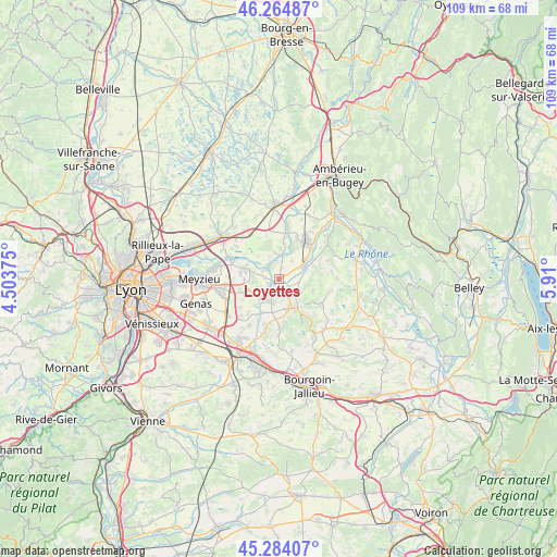
Loyettes GPS coordinates[2]
45° 46' 35.868" North, 5° 12' 24.732" East
| Map corner | latitude | longitude |
|---|---|---|
| Upper-left | 46.26487°, | 4.50375° |
| Center: | 45.77663°, | 5.20687° |
| Lower-right: | 45.28407°, | 5.91° |
| Map W x H: | 109.1×109.1 km | = 67.8×67.8mi |
| max Lat: | 51.07786° ⇑69.6% North |
| Loyettes: | 45.77663° |
| min Lat: | ⇓30.4% South 41.3874° |
| min Long | Loyettes | max Long |
| -5.08615° | 5.20687° | 9.52242° |
| W 79.9%⇐ | ⇒20.1% E |
Elevation
Elevation of Loyettes is 194 m = 636 ft, and this is 0.30000000000001 m = 1 ft above average elevation for this country.
| Max E: |
2333 m = 7654 ft | 35% |
| Loyettes | 194 m 636 ft | |
| Avg. | 193.7 m = 635 ft | |
Min E: |
-1 m = -3 ft | 65% |
See also: France elevation on elevation.city.
Geographical zone
Loyettes is located in North temperate zone (between Tropic of Cancer and the Arctic Circle). Distance of this North polar circle is 2311.3 km =1436.2 mi to North.| Distance of | km | miles | from Loyettes |
|---|---|---|---|
| North Pole | 4917.2 | 3055.4 | to North |
| Arctic Circle | 2311.3 | 1436.2 | to North |
| Tropic Cancer | 2484 | 1543.5 | to South |
| Equator | 5089.9 | 3162.7 | to South |


Nearby cities:
15 places around Loyettes: (largest is in red/bold)
• Annoisin
7 km =4.3 mi,  108°
108°
• Anthon
3.2 km =2 mi,  299°
299°
• Charvieu-Chavagneux
5.3 km =3.3 mi,  236°
236°
• Chavanoz
1.7 km =1.1 mi, 238°
• Chozeau
8.6 km =5.3 mi,  181°
181°
• Crémieu
6.6 km =4.1 mi,  150°
150°
• Hières-sur-Amby
7.1 km =4.4 mi,  71°
71°
• Janneyrias
7.8 km =4.8 mi,  249°
249°
• Leyrieu
4.3 km =2.7 mi,  115°
115°
• Pont-de-Chéruy
3.7 km =2.3 mi,  225°
225°
• Saint-Jean-de-Niost
6.4 km =4 mi,  6°
6°
• Saint-Maurice-de-Gourdans
5.2 km =3.2 mi,  349°
349°
• Saint-Romain-de-Jalionas
2.4 km =1.5 mi,  159°
159°
• Tignieu
3.1 km =1.9 mi,  206°
206°
• Villemoirieu
6.6 km =4.1 mi,  167°
167°
Sources, notices
• [Note1] Compared only with cities in France existing in our database
• [Src1] Map data: © OpenStreetMap contributors (CC-BY-SA)
• [Src2] Other city data from geonames.org with taken over terms of usage.
• [Src3] Geographical zone / Annual Mean Temperature by Robert A. Rohde @ Wikipedia
