Saint-Jean-de-Niost geodata
Saint-Jean-de-Niost (Auvergne-Rhône-Alpes) is a populated place; located in France in Europe/Paris (GMT+2) time zone. With population of 1,357 people, there are 6778 cities with bigger population in this country. Compared to other cities in France, 68.8% of cities are located further ↑North; 79.9% of cities are located further ←West and 72% of cities have lower elevation than Saint-Jean-de-Niost. Note1
Administrative division(s):
- Level 1: Auvergne-Rhône-Alpes
- Level 2: Département de l'Ain
- Level 3: Arrondissement de Belley
- Level 4: Saint-Jean-de-Niost


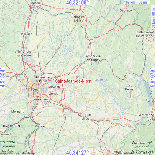
Saint-Jean-de-Niost GPS coordinates[2]
45° 49' 59.988" North, 5° 13' 0.012" East
| Map corner | latitude | longitude |
|---|---|---|
| Upper-left | 46.32108°, | 4.51354° |
| Center: | 45.83333°, | 5.21667° |
| Lower-right: | 45.34127°, | 5.91979° |
| Map W x H: | 108.9×108.9 km | = 67.7×67.7mi |
| max Lat: | 51.07786° ⇑68.8% North |
| Saint-Jean-de-Niost: | 45.83333° |
| min Lat: | ⇓31.2% South 41.3874° |
| min Long | Saint-Jean-de-N | max Long |
| -5.08615° | 5.21667° | 9.52242° |
| W 79.9%⇐ | ⇒20.1% E |
Elevation
Elevation of Saint-Jean-de-Niost is 230 m = 755 ft, and this is 36.3 m = 119 ft above average elevation for this country.
| Max E: |
2333 m = 7654 ft | 28% |
| Saint-Jean-de-Niost | 230 m 755 ft | |
| Avg. | 193.7 m = 635 ft | |
Min E: |
-1 m = -3 ft | 72% |
See also: France elevation on elevation.city.
Geographical zone
Saint-Jean-de-Niost is located in North temperate zone (between Tropic of Cancer and the Arctic Circle). Distance of this North polar circle is 2305 km =1432.3 mi to North.| Distance of | km | miles | from Saint-Jean-de-Niost |
|---|---|---|---|
| North Pole | 4910.9 | 3051.5 | to North |
| Arctic Circle | 2305 | 1432.3 | to North |
| Tropic Cancer | 2490.3 | 1547.4 | to South |
| Equator | 5096.2 | 3166.6 | to South |


Nearby cities:
15 places around Saint-Jean-de-Niost: (largest is in red/bold)
• Anthon
5.9 km =3.7 mi,  217°
217°
• Blyes
3.2 km =2 mi,  58°
58°
• Bourg-Saint-Christophe
7.9 km =4.9 mi,  319°
319°
• Béligneux
7.9 km =4.9 mi,  298°
298°
• Charnoz-sur-Ain
3.7 km =2.3 mi,  0°
0°
• Chavanoz
7.5 km =4.7 mi,  197°
197°
• Chazey-sur-Ain
7.2 km =4.5 mi,  23°
23°
• Hières-sur-Amby
7.2 km =4.5 mi,  124°
124°
• Loyettes
6.4 km =4 mi,  186°
186°
• Meximieux
8.4 km =5.2 mi,  350°
350°
• Pérouges
8.5 km =5.3 mi,  338°
338°
• Saint-Maurice-de-Gourdans
2.1 km =1.3 mi,  234°
234°
• Saint-Romain-de-Jalionas
8.5 km =5.3 mi,  179°
179°
• Saint-Vulbas
5.7 km =3.5 mi,  92°
92°
• Sainte-Julie
7.9 km =4.9 mi,  37°
37°
Sources, notices
• [Note1] Compared only with cities in France existing in our database
• [Src1] Map data: © OpenStreetMap contributors (CC-BY-SA)
• [Src2] Other city data from geonames.org with taken over terms of usage.
• [Src3] Geographical zone / Annual Mean Temperature by Robert A. Rohde @ Wikipedia
