Saint-Maurice-de-Gourdans geodata
Saint-Maurice-de-Gourdans (Auvergne-Rhône-Alpes) is a populated place; located in France in Europe/Paris (GMT+2) time zone. With population of 2,131 people, there are 4511 cities with bigger population in this country. Compared to other cities in France, 69% of cities are located further ↑North; 79.7% of cities are located further ←West and 67.2% of cities have lower elevation than Saint-Maurice-de-Gourdans. Note1
Administrative division(s):
- Level 1: Auvergne-Rhône-Alpes
- Level 2: Département de l'Ain
- Level 3: Arrondissement de Belley
- Level 4: Saint-Maurice-de-Gourdans
Current local time in Saint-Maurice-de-Gourdans:
02:22 PM, SaturdayDifference from your time zone: hours


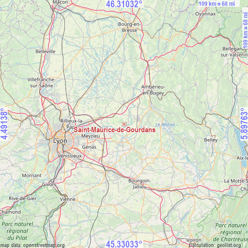
Saint-Maurice-de-Gourdans GPS coordinates[2]
45° 49' 20.928" North, 5° 11' 40.2" East
| Map corner | latitude | longitude |
|---|---|---|
| Upper-left | 46.31032°, | 4.49138° |
| Center: | 45.82248°, | 5.1945° |
| Lower-right: | 45.33033°, | 5.89763° |
| Map W x H: | 109×109 km | = 67.7×67.7mi |
| max Lat: | 51.07786° ⇑69% North |
| Saint-Maurice-de-Gourdans: | 45.82248° |
| min Lat: | ⇓31% South 41.3874° |
| min Long | Saint-Maurice-d | max Long |
| -5.08615° | 5.1945° | 9.52242° |
| W 79.7%⇐ | ⇒20.3% E |
Elevation
Elevation of Saint-Maurice-de-Gourdans is 205 m = 673 ft, and this is 11.3 m = 37 ft above average elevation for this country.
| Max E: |
2333 m = 7654 ft | 32.8% |
| Saint-Maurice-de-Gourdans | 205 m 673 ft | |
| Avg. | 193.7 m = 635 ft | |
Min E: |
-1 m = -3 ft | 67.2% |
See also: France elevation on elevation.city.
Geographical zone
Saint-Maurice-de-Gourdans is located in North temperate zone (between Tropic of Cancer and the Arctic Circle). Distance of this North polar circle is 2306.2 km =1433 mi to North.| Distance of | km | miles | from Saint-Maurice-de-Gourdans |
|---|---|---|---|
| North Pole | 4912.1 | 3052.2 | to North |
| Arctic Circle | 2306.2 | 1433 | to North |
| Tropic Cancer | 2489.1 | 1546.7 | to South |
| Equator | 5095 | 3165.9 | to South |


Nearby cities:
15 places around Saint-Maurice-de-Gourdans: (largest is in red/bold)
• Anthon
4 km =2.5 mi,  207°
207°
• Balan
7.5 km =4.7 mi,  279°
279°
• Blyes
5.3 km =3.3 mi,  57°
57°
• Bourg-Saint-Christophe
8 km =5 mi,  334°
334°
• Béligneux
7.2 km =4.5 mi,  314°
314°
• Charnoz-sur-Ain
5.2 km =3.2 mi,  19°
19°
• Chavanoz
6 km =3.7 mi,  184°
184°
• Hières-sur-Amby
8.2 km =5.1 mi,  110°
110°
• Leyrieu
8.4 km =5.2 mi,  145°
145°
• Loyettes
5.2 km =3.2 mi,  169°
169°
• Pont-de-Chéruy
7.9 km =4.9 mi,  192°
192°
• Saint-Jean-de-Niost
2.1 km =1.3 mi,  54°
54°
• Saint-Romain-de-Jalionas
7.5 km =4.7 mi, 166°
• Saint-Vulbas
7.5 km =4.7 mi,  82°
82°
• Tignieu
7.9 km =4.9 mi, 183°
Sources, notices
• [Note1] Compared only with cities in France existing in our database
• [Src1] Map data: © OpenStreetMap contributors (CC-BY-SA)
• [Src2] Other city data from geonames.org with taken over terms of usage.
• [Src3] Geographical zone / Annual Mean Temperature by Robert A. Rohde @ Wikipedia
