Louhans geodata
Louhans (Bourgogne-Franche-Comté) is a seat of a third-order administrative division; located in France in Europe/Paris (GMT+2) time zone. With population of 6,466 people, there are 1527 cities with bigger population in this country. Compared to other cities in France, 59% of cities are located further ↑North; 80% of cities are located further ←West and 62.1% of cities have lower elevation than Louhans. Note1
Administrative division(s):
- Level 1: Bourgogne-Franche-Comté
- Level 2: Département de Saône-et-Loire
- Level 3: Arrondissement de Louhans
- Level 4: Louhans


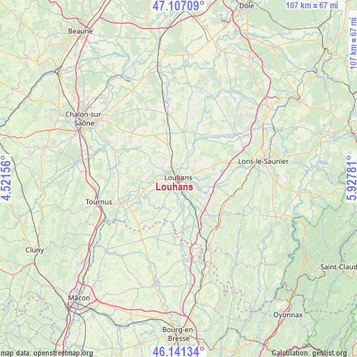
Louhans GPS coordinates[2]
46° 37' 34.932" North, 5° 13' 28.848" East
| Map corner | latitude | longitude |
|---|---|---|
| Upper-left | 47.10709°, | 4.52156° |
| Center: | 46.62637°, | 5.22468° |
| Lower-right: | 46.14134°, | 5.92781° |
| Map W x H: | 107.4×107.4 km | = 66.7×66.7mi |
| max Lat: | 51.07786° ⇑59% North |
| Louhans: | 46.62637° |
| min Lat: | ⇓41% South 41.3874° |
| min Long | Louhans | max Long |
| -5.08615° | 5.22468° | 9.52242° |
| W 80%⇐ | ⇒20% E |
Elevation
Elevation of Louhans is 180 m = 591 ft, and this is 13.7 m = 45 ft below average elevation for this country.
| Max E: |
2333 m = 7654 ft | 37.9% |
| Avg. | 193.7 m = 635 ft | |
| Louhans | 180 m = 591 ft | |
Min E: |
-1 m = -3 ft | 62.1% |
See also: France elevation on elevation.city.
Geographical zone
Louhans is located in North temperate zone (between Tropic of Cancer and the Arctic Circle). Distance of this North polar circle is 2216.8 km =1377.5 mi to North.| Distance of | km | miles | from Louhans |
|---|---|---|---|
| North Pole | 4822.7 | 2996.7 | to North |
| Arctic Circle | 2216.8 | 1377.5 | to North |
| Tropic Cancer | 2578.4 | 1602.1 | to South |
| Equator | 5184.4 | 3221.4 | to South |


Nearby cities:
15 places around Louhans: (largest is in red/bold)
• Beaurepaire-en-Bresse
13.3 km =8.3 mi,  69°
69°
• Branges
3.7 km =2.3 mi,  303°
303°
• Bruailles
3.5 km =2.2 mi,  166°
166°
• Frangy-en-Bresse
14.5 km =9 mi,  34°
34°
• Frontenaud
9.7 km =6 mi,  147°
147°
• Le Fay
9.2 km =5.7 mi,  60°
60°
• Montpont-en-Bresse
9 km =5.6 mi,  210°
210°
• Montret
10.4 km =6.5 mi,  306°
306°
• Rancy
10.6 km =6.6 mi,  252°
252°
• Sagy
7.1 km =4.4 mi,  113°
113°
• Saillenard
13.3 km =8.3 mi, 57°
• Saint-Germain-du-Bois
14.2 km =8.8 mi,  6°
6°
• Saint-Usuge
6.2 km =3.9 mi,  18°
18°
• Simard
10.9 km =6.8 mi,  342°
342°
• Sornay
3.4 km =2.1 mi,  277°
277°
Sources, notices
• [Note1] Compared only with cities in France existing in our database
• [Src1] Map data: © OpenStreetMap contributors (CC-BY-SA)
• [Src2] Other city data from geonames.org with taken over terms of usage.
• [Src3] Geographical zone / Annual Mean Temperature by Robert A. Rohde @ Wikipedia
