Rancy geodata
Rancy (Bourgogne-Franche-Comté) is a populated place; located in France in Europe/Paris (GMT+2) time zone. With population of 517 people, there are 14885 cities with bigger population in this country. Compared to other cities in France, 59.3% of cities are located further ↑North; 78.6% of cities are located further ←West and 65.4% of cities have lower elevation than Rancy. Note1
Administrative division(s):
- Level 1: Bourgogne-Franche-Comté
- Level 2: Département de Saône-et-Loire
- Level 3: Arrondissement de Louhans
- Level 4: Rancy


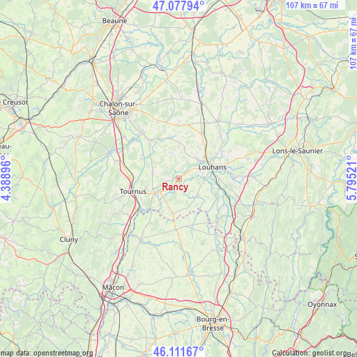
Rancy GPS coordinates[2]
46° 35' 49.056" North, 5° 5' 31.488" East
| Map corner | latitude | longitude |
|---|---|---|
| Upper-left | 47.07794°, | 4.38896° |
| Center: | 46.59696°, | 5.09208° |
| Lower-right: | 46.11167°, | 5.79521° |
| Map W x H: | 107.4×107.4 km | = 66.7×66.7mi |
| max Lat: | 51.07786° ⇑59.3% North |
| Rancy: | 46.59696° |
| min Lat: | ⇓40.7% South 41.3874° |
| min Long | Rancy | max Long |
| -5.08615° | 5.09208° | 9.52242° |
| W 78.6%⇐ | ⇒21.4% E |
Elevation
Elevation of Rancy is 196 m = 643 ft, and this is 2.3 m = 8 ft above average elevation for this country.
| Max E: |
2333 m = 7654 ft | 34.6% |
| Rancy | 196 m 643 ft | |
| Avg. | 193.7 m = 635 ft | |
Min E: |
-1 m = -3 ft | 65.4% |
See also: France elevation on elevation.city.
Geographical zone
Rancy is located in North temperate zone (between Tropic of Cancer and the Arctic Circle). Distance of this North polar circle is 2220.1 km =1379.5 mi to North.| Distance of | km | miles | from Rancy |
|---|---|---|---|
| North Pole | 4826 | 2998.7 | to North |
| Arctic Circle | 2220.1 | 1379.5 | to North |
| Tropic Cancer | 2575.2 | 1600.2 | to South |
| Equator | 5181.1 | 3219.4 | to South |


Nearby cities:
15 places around Rancy: (largest is in red/bold)
• Baudrières
10.5 km =6.5 mi,  323°
323°
• Branges
8.8 km =5.5 mi,  53°
53°
• Bruailles
11 km =6.8 mi,  90°
90°
• Cuisery
8.5 km =5.3 mi,  238°
238°
• Gigny-sur-Saône
13.3 km =8.3 mi,  302°
302°
• Lacrost
13 km =8.1 mi,  250°
250°
• Loisy
5.3 km =3.3 mi, 250°
• Louhans
10.6 km =6.6 mi,  72°
72°
• Montpont-en-Bresse
7.2 km =4.5 mi,  129°
129°
• Montret
9.6 km =6 mi,  10°
10°
• Préty
12.9 km =8 mi, 242°
• Romenay
10.7 km =6.6 mi,  189°
189°
• Saint-Étienne-en-Bresse
12.5 km =7.8 mi,  345°
345°
• Simandre
8.5 km =5.3 mi,  290°
290°
• Sornay
7.7 km =4.8 mi,  61°
61°
Sources, notices
• [Note1] Compared only with cities in France existing in our database
• [Src1] Map data: © OpenStreetMap contributors (CC-BY-SA)
• [Src2] Other city data from geonames.org with taken over terms of usage.
• [Src3] Geographical zone / Annual Mean Temperature by Robert A. Rohde @ Wikipedia
