Lormes geodata
Lormes (Bourgogne-Franche-Comté) is a populated place; located in France in Europe/Paris (GMT+2) time zone. With population of 1,389 people, there are 6654 cities with bigger population in this country. Compared to other cities in France, 51.7% of cities are located further ↑North; 66.4% of cities are located further ←West and 89.9% of cities have lower elevation than Lormes. Note1
Administrative division(s):
- Level 1: Bourgogne-Franche-Comté
- Level 2: Département de la Nièvre
- Level 3: Arrondissement de Château-Chinon (Ville)
- Level 4: Lormes


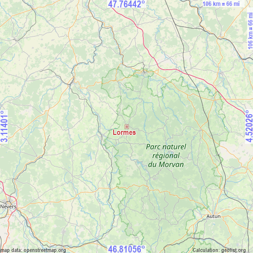
Lormes GPS coordinates[2]
47° 17' 22.704" North, 3° 49' 1.704" East
| Map corner | latitude | longitude |
|---|---|---|
| Upper-left | 47.76442°, | 3.11401° |
| Center: | 47.28964°, | 3.81714° |
| Lower-right: | 46.81056°, | 4.52026° |
| Map W x H: | 106.1×106.1 km | = 65.9×65.9mi |
| max Lat: | 51.07786° ⇑51.7% North |
| Lormes: | 47.28964° |
| min Lat: | ⇓48.3% South 41.3874° |
| min Long | Lormes | max Long |
| -5.08615° | 3.81714° | 9.52242° |
| W 66.4%⇐ | ⇒33.6% E |
Elevation
Elevation of Lormes is 424 m = 1391 ft, and this is 230.3 m = 756 ft above average elevation for this country.
| Max E: |
2333 m = 7654 ft | 10.1% |
| Lormes | 424 m 1391 ft | |
| Avg. | 193.7 m = 635 ft | |
Min E: |
-1 m = -3 ft | 89.9% |
See also: France elevation on elevation.city.
Geographical zone
Lormes is located in North temperate zone (between Tropic of Cancer and the Arctic Circle). Distance of this North polar circle is 2143.1 km =1331.7 mi to North.| Distance of | km | miles | from Lormes |
|---|---|---|---|
| North Pole | 4748.9 | 2950.8 | to North |
| Arctic Circle | 2143.1 | 1331.7 | to North |
| Tropic Cancer | 2652.2 | 1648 | to South |
| Equator | 5258.1 | 3267.2 | to South |


Nearby cities:
15 places around Lormes: (largest is in red/bold)
• Avallon
23.3 km =14.5 mi,  17°
17°
• Brassy
9.4 km =5.8 mi,  109°
109°
• Cervon
7.1 km =4.4 mi,  220°
220°
• Château-Chinon(Campagne)
28.3 km =17.6 mi,  160°
160°
• Château-Chinon(Ville)
26.3 km =16.3 mi, 160°
• Châtillon-en-Bazois
28.7 km =17.8 mi,  204°
204°
• Corbigny
10.8 km =6.7 mi,  250°
250°
• Dornecy
23.9 km =14.9 mi,  312°
312°
• Montsauche-les-Settons
17.1 km =10.6 mi,  118°
118°
• Ouroux-en-Morvan
15.5 km =9.6 mi,  139°
139°
• Quarré-les-Tombes
16.2 km =10.1 mi,  57°
57°
• Rouvray
26.3 km =16.3 mi, 55°
• Sauvigny-le-Bois
26.6 km =16.5 mi, 20°
• Tannay
19.1 km =11.9 mi,  297°
297°
• Vézelay
20.3 km =12.6 mi,  344°
344°
Sources, notices
• [Note1] Compared only with cities in France existing in our database
• [Src1] Map data: © OpenStreetMap contributors (CC-BY-SA)
• [Src2] Other city data from geonames.org with taken over terms of usage.
• [Src3] Geographical zone / Annual Mean Temperature by Robert A. Rohde @ Wikipedia
