Brassy geodata
Brassy (Bourgogne-Franche-Comté) is a populated place; located in France in Europe/Paris (GMT+2) time zone. With population of 630 people, there are 12819 cities with bigger population in this country. Compared to other cities in France, 52.1% of cities are located further ↑North; 67.2% of cities are located further ←West and 89.3% of cities have lower elevation than Brassy. Note1
Administrative division(s):
- Level 1: Bourgogne-Franche-Comté
- Level 2: Département de la Nièvre
- Level 3: Arrondissement de Château-Chinon (Ville)
- Level 4: Brassy


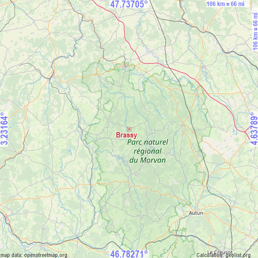
Brassy GPS coordinates[2]
47° 15' 43.308" North, 3° 56' 5.136" East
| Map corner | latitude | longitude |
|---|---|---|
| Upper-left | 47.73705°, | 3.23164° |
| Center: | 47.26203°, | 3.93476° |
| Lower-right: | 46.78271°, | 4.63789° |
| Map W x H: | 106.1×106.1 km | = 65.9×65.9mi |
| max Lat: | 51.07786° ⇑52.1% North |
| Brassy: | 47.26203° |
| min Lat: | ⇓47.9% South 41.3874° |
| min Long | Brassy | max Long |
| -5.08615° | 3.93476° | 9.52242° |
| W 67.2%⇐ | ⇒32.8% E |
Elevation
Elevation of Brassy is 413 m = 1355 ft, and this is 219.3 m = 719 ft above average elevation for this country.
| Max E: |
2333 m = 7654 ft | 10.7% |
| Brassy | 413 m 1355 ft | |
| Avg. | 193.7 m = 635 ft | |
Min E: |
-1 m = -3 ft | 89.3% |
See also: France elevation on elevation.city.
Geographical zone
Brassy is located in North temperate zone (between Tropic of Cancer and the Arctic Circle). Distance of this North polar circle is 2146.1 km =1333.5 mi to North.| Distance of | km | miles | from Brassy |
|---|---|---|---|
| North Pole | 4752 | 2952.8 | to North |
| Arctic Circle | 2146.1 | 1333.5 | to North |
| Tropic Cancer | 2649.1 | 1646.1 | to South |
| Equator | 5255 | 3265.3 | to South |


Nearby cities:
15 places around Brassy: (largest is in red/bold)
• Alligny-en-Morvan
19.6 km =12.2 mi,  110°
110°
• Anost
24 km =14.9 mi,  148°
148°
• Arleuf
25.1 km =15.6 mi,  164°
164°
• Avallon
25.4 km =15.8 mi,  355°
355°
• Cervon
13.7 km =8.5 mi,  260°
260°
• Château-Chinon(Campagne)
23.6 km =14.7 mi,  178°
178°
• Château-Chinon(Ville)
21.7 km =13.5 mi, 180°
• Corbigny
19 km =11.8 mi,  268°
268°
• La Roche-en-Brenil
22.7 km =14.1 mi,  54°
54°
• Lormes
9.4 km =5.8 mi,  289°
289°
• Montsauche-les-Settons
8 km =5 mi,  129°
129°
• Ouroux-en-Morvan
8.8 km =5.5 mi,  172°
172°
• Quarré-les-Tombes
12.8 km =8 mi,  21°
21°
• Rouvray
22.1 km =13.7 mi,  35°
35°
• Saulieu
22.3 km =13.9 mi,  84°
84°
Sources, notices
• [Note1] Compared only with cities in France existing in our database
• [Src1] Map data: © OpenStreetMap contributors (CC-BY-SA)
• [Src2] Other city data from geonames.org with taken over terms of usage.
• [Src3] Geographical zone / Annual Mean Temperature by Robert A. Rohde @ Wikipedia
