Tannay geodata
Tannay (Bourgogne-Franche-Comté) is a populated place; located in France in Europe/Paris (GMT+2) time zone. With population of 603 people, there are 13268 cities with bigger population in this country. Compared to other cities in France, 50.5% of cities are located further ↑North; 65% of cities are located further ←West and 74% of cities have lower elevation than Tannay. Note1
Administrative division(s):
- Level 1: Bourgogne-Franche-Comté
- Level 2: Département de la Nièvre
- Level 3: Arrondissement de Clamecy
- Level 4: Tannay


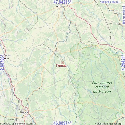
Tannay GPS coordinates[2]
47° 22' 5.196" North, 3° 35' 27.888" East
| Map corner | latitude | longitude |
|---|---|---|
| Upper-left | 47.84218°, | 2.88796° |
| Center: | 47.36811°, | 3.59108° |
| Lower-right: | 46.88974°, | 4.29421° |
| Map W x H: | 105.9×105.9 km | = 65.8×65.8mi |
| max Lat: | 51.07786° ⇑50.5% North |
| Tannay: | 47.36811° |
| min Lat: | ⇓49.5% South 41.3874° |
| min Long | Tannay | max Long |
| -5.08615° | 3.59108° | 9.52242° |
| W 65%⇐ | ⇒35% E |
Elevation
Elevation of Tannay is 242 m = 794 ft, and this is 48.3 m = 158 ft above average elevation for this country.
| Max E: |
2333 m = 7654 ft | 26% |
| Tannay | 242 m 794 ft | |
| Avg. | 193.7 m = 635 ft | |
Min E: |
-1 m = -3 ft | 74% |
See also: France elevation on elevation.city.
Geographical zone
Tannay is located in North temperate zone (between Tropic of Cancer and the Arctic Circle). Distance of this North polar circle is 2134.3 km =1326.2 mi to North.| Distance of | km | miles | from Tannay |
|---|---|---|---|
| North Pole | 4740.2 | 2945.4 | to North |
| Arctic Circle | 2134.3 | 1326.2 | to North |
| Tropic Cancer | 2660.9 | 1653.4 | to South |
| Equator | 5266.8 | 3272.6 | to South |


Nearby cities:
15 places around Tannay: (largest is in red/bold)
• Avallon
27.4 km =17 mi,  60°
60°
• Cervon
18.8 km =11.7 mi,  138°
138°
• Châtel-Censoir
18.7 km =11.6 mi,  9°
9°
• Clamecy
11.6 km =7.2 mi,  332°
332°
• Corbigny
14.2 km =8.8 mi,  150°
150°
• Coulanges-sur-Yonne
18 km =11.2 mi,  347°
347°
• Dornecy
7.6 km =4.7 mi,  356°
356°
• Entrains-sur-Nohain
27.3 km =17 mi,  293°
293°
• Fontenailles
22.4 km =13.9 mi, 334°
• Lormes
19.1 km =11.9 mi,  117°
117°
• Mailly-la-Ville
26.8 km =16.7 mi, 14°
• Mailly-le-Château
25.6 km =15.9 mi, 7°
• Varzy
15.5 km =9.6 mi,  265°
265°
• Vézelay
15.9 km =9.9 mi,  46°
46°
• Étais-la-Sauvin
23.8 km =14.8 mi,  309°
309°
Sources, notices
• [Note1] Compared only with cities in France existing in our database
• [Src1] Map data: © OpenStreetMap contributors (CC-BY-SA)
• [Src2] Other city data from geonames.org with taken over terms of usage.
• [Src3] Geographical zone / Annual Mean Temperature by Robert A. Rohde @ Wikipedia
