Longchaumois geodata
Longchaumois (Bourgogne-Franche-Comté) is a populated place; located in France in Europe/Paris (GMT+2) time zone. With population of 1,138 people, there are 7900 cities with bigger population in this country. Compared to other cities in France, 60.5% of cities are located further ↑North; 86.3% of cities are located further ←West and 98.6% of cities have lower elevation than Longchaumois. Note1
Administrative division(s):
- Level 1: Bourgogne-Franche-Comté
- Level 2: Jura
- Level 3: Arrondissement de Saint-Claude
- Level 4: Longchaumois


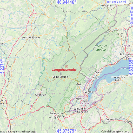
Longchaumois GPS coordinates[2]
46° 27' 44.208" North, 5° 55' 49.872" East
| Map corner | latitude | longitude |
|---|---|---|
| Upper-left | 46.94446°, | 5.2274° |
| Center: | 46.46228°, | 5.93052° |
| Lower-right: | 45.97579°, | 6.63365° |
| Map W x H: | 107.7×107.7 km | = 66.9×66.9mi |
| max Lat: | 51.07786° ⇑60.5% North |
| Longchaumois: | 46.46228° |
| min Lat: | ⇓39.5% South 41.3874° |
| min Long | Longchaumois | max Long |
| -5.08615° | 5.93052° | 9.52242° |
| W 86.3%⇐ | ⇒13.7% E |
Elevation
Elevation of Longchaumois is 894 m = 2933 ft, and this is 700.3 m = 2298 ft above average elevation for this country.
| Max E: |
2333 m = 7654 ft | 1.4% |
| Longchaumois | 894 m 2933 ft | |
| Avg. | 193.7 m = 635 ft | |
Min E: |
-1 m = -3 ft | 98.6% |
See also: France elevation on elevation.city.
Geographical zone
Longchaumois is located in North temperate zone (between Tropic of Cancer and the Arctic Circle). Distance of this North polar circle is 2235.1 km =1388.8 mi to North.| Distance of | km | miles | from Longchaumois |
|---|---|---|---|
| North Pole | 4840.9 | 3008 | to North |
| Arctic Circle | 2235.1 | 1388.8 | to North |
| Tropic Cancer | 2560.2 | 1590.8 | to South |
| Equator | 5166.1 | 3210.1 | to South |


Nearby cities:
15 places around Longchaumois: (largest is in red/bold)
• Chassal
16.2 km =10.1 mi,  223°
223°
• La Chaux-du-Dombief
15.8 km =9.8 mi,  351°
351°
• Lavans-lès-Saint-Claude
14.3 km =8.9 mi,  232°
232°
• Les Rousses
10.5 km =6.5 mi,  76°
76°
• Moirans-en-Montagne
16 km =9.9 mi,  258°
258°
• Morbier
10.5 km =6.5 mi,  38°
38°
• Morez
10.1 km =6.3 mi,  46°
46°
• Pratz
16 km =9.9 mi, 233°
• Prémanon
6.8 km =4.2 mi,  89°
89°
• Saint-Claude
9.8 km =6.1 mi,  210°
210°
• Saint-Laurent-en-Grandvaux
13.5 km =8.4 mi,  6°
6°
• Saint-Lupicin
12.6 km =7.8 mi,  236°
236°
• Septmoncel
10.2 km =6.3 mi,  187°
187°
• Valfin-lès-Saint-Claude
6.4 km =4 mi, 244°
• Villard-Saint-Sauveur
12.5 km =7.8 mi,  204°
204°
Sources, notices
• [Note1] Compared only with cities in France existing in our database
• [Src1] Map data: © OpenStreetMap contributors (CC-BY-SA)
• [Src2] Other city data from geonames.org with taken over terms of usage.
• [Src3] Geographical zone / Annual Mean Temperature by Robert A. Rohde @ Wikipedia
