Prémanon geodata
Prémanon (Bourgogne-Franche-Comté) is a populated place; located in France in Europe/Paris (GMT+2) time zone. With population of 685 people, there are 12013 cities with bigger population in this country. Compared to other cities in France, 60.4% of cities are located further ↑North; 87.2% of cities are located further ←West and 99.5% of cities have lower elevation than Prémanon. Note1
Administrative division(s):
- Level 1: Bourgogne-Franche-Comté
- Level 2: Jura
- Level 3: Arrondissement de Saint-Claude
- Level 4: Prémanon


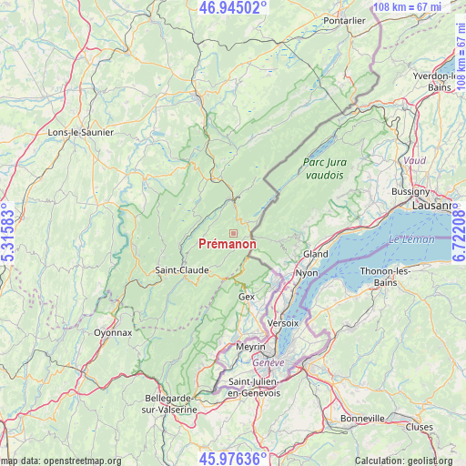
Prémanon GPS coordinates[2]
46° 27' 46.224" North, 6° 1' 8.256" East
| Map corner | latitude | longitude |
|---|---|---|
| Upper-left | 46.94502°, | 5.31583° |
| Center: | 46.46284°, | 6.01896° |
| Lower-right: | 45.97636°, | 6.72208° |
| Map W x H: | 107.7×107.7 km | = 66.9×66.9mi |
| max Lat: | 51.07786° ⇑60.4% North |
| Prémanon: | 46.46284° |
| min Lat: | ⇓39.6% South 41.3874° |
| min Long | Prémanon | max Long |
| -5.08615° | 6.01896° | 9.52242° |
| W 87.2%⇐ | ⇒12.8% E |
Elevation
Elevation of Prémanon is 1128 m = 3701 ft, and this is 934.3 m = 3065 ft above average elevation for this country.
| Max E: |
2333 m = 7654 ft | 0.5% |
| Prémanon | 1128 m 3701 ft | |
| Avg. | 193.7 m = 635 ft | |
Min E: |
-1 m = -3 ft | 99.5% |
See also: France elevation on elevation.city.
Geographical zone
Prémanon is located in North temperate zone (between Tropic of Cancer and the Arctic Circle). Distance of this North polar circle is 2235 km =1388.8 mi to North.| Distance of | km | miles | from Prémanon |
|---|---|---|---|
| North Pole | 4840.9 | 3008 | to North |
| Arctic Circle | 2235 | 1388.8 | to North |
| Tropic Cancer | 2560.3 | 1590.9 | to South |
| Equator | 5166.2 | 3210.1 | to South |


Nearby cities:
15 places around Prémanon: (largest is in red/bold)
• Bois-d’Amont
12 km =7.5 mi,  49°
49°
• Cessy
16.4 km =10.2 mi,  164°
164°
• Divonne-les-Bains
14.7 km =9.1 mi,  142°
142°
• Gex
14.7 km =9.1 mi,  168°
168°
• Grilly
16.4 km =10.2 mi,  153°
153°
• Les Rousses
4.1 km =2.5 mi,  55°
55°
• Longchaumois
6.8 km =4.2 mi,  269°
269°
• Morbier
8.2 km =5.1 mi,  358°
358°
• Morez
7 km =4.3 mi,  4°
4°
• Saint-Claude
14.5 km =9 mi,  234°
234°
• Saint-Laurent-en-Grandvaux
14.4 km =8.9 mi,  338°
338°
• Septmoncel
13 km =8.1 mi,  218°
218°
• Valfin-lès-Saint-Claude
12.9 km =8 mi,  257°
257°
• Villard-Saint-Sauveur
16.6 km =10.3 mi, 226°
• Échenevex
17.2 km =10.7 mi, 174°
Sources, notices
• [Note1] Compared only with cities in France existing in our database
• [Src1] Map data: © OpenStreetMap contributors (CC-BY-SA)
• [Src2] Other city data from geonames.org with taken over terms of usage.
• [Src3] Geographical zone / Annual Mean Temperature by Robert A. Rohde @ Wikipedia
