Livarot geodata
Livarot (Normandy) is a populated place; located in France in Europe/Paris (GMT+2) time zone. With population of 2,656 people, there are 3669 cities with bigger population in this country. Compared to other cities in France, 79.8% of cities are located further ↓South; 76.7% of cities are located further →East and 74.1% of cities have higher elevation than Livarot. Note1
Administrative division(s):
- Level 1: Normandy
- Level 2: Calvados
- Level 3: Arrondissement de Lisieux
- Level 4: Livarot-Pays-d'Auge


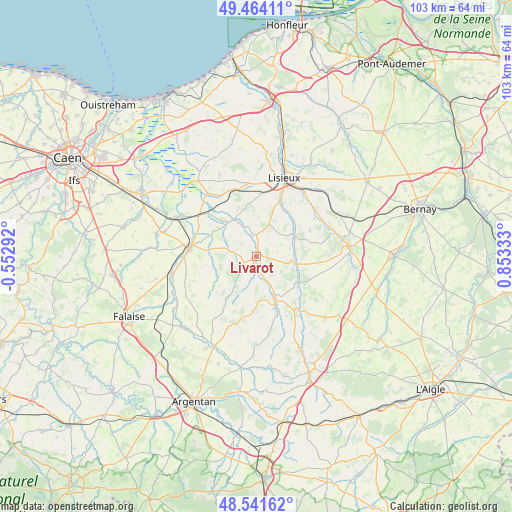
Livarot GPS coordinates[2]
49° 0' 18" North, 0° 9' 0.72" East
| Map corner | latitude | longitude |
|---|---|---|
| Upper-left | 49.46411°, | -0.55292° |
| Center: | 49.005°, | 0.1502° |
| Lower-right: | 48.54162°, | 0.85333° |
| Map W x H: | 102.6×102.6 km | = 63.8×63.8mi |
| max Lat: | 51.07786° ⇑20.2% North |
| Livarot: | 49.005° |
| min Lat: | ⇓79.8% South 41.3874° |
| min Long | Livarot | max Long |
| -5.08615° | 0.1502° | 9.52242° |
| W 23.3%⇐ | ⇒76.7% E |
Elevation
Elevation of Livarot is 69 m = 226 ft, and this is 124.7 m = 409 ft below average elevation for this country.
| Max E: |
2333 m = 7654 ft | 74.1% |
| Avg. | 193.7 m = 635 ft | |
| Livarot | 69 m = 226 ft | |
Min E: |
-1 m = -3 ft | 25.9% |
See also: France elevation on elevation.city.
Geographical zone
Livarot is located in North temperate zone (between Tropic of Cancer and the Arctic Circle). Distance of this North polar circle is 1952.3 km =1213.1 mi to North.| Distance of | km | miles | from Livarot |
|---|---|---|---|
| North Pole | 4558.2 | 2832.3 | to North |
| Arctic Circle | 1952.3 | 1213.1 | to North |
| Tropic Cancer | 2842.9 | 1766.5 | to South |
| Equator | 5448.8 | 3385.7 | to South |


Nearby cities:
15 places around Livarot: (largest is in red/bold)
• Beuvillers
15.8 km =9.8 mi,  28°
28°
• Crevecoeur-en-Auge
15.8 km =9.8 mi,  321°
321°
• Fervaques
8.5 km =5.3 mi,  62°
62°
• La Chapelle-Yvon
15.3 km =9.5 mi, 64°
• Le Mesnil-Guillaume
15 km =9.3 mi,  42°
42°
• Le Mesnil-Mauger
13.2 km =8.2 mi,  311°
311°
• Notre-Dame-de-Fresnay
9.1 km =5.7 mi,  239°
239°
• Saint-Cyr-du-Ronceray
12 km =7.5 mi, 63°
• Saint-Désir
15.8 km =9.8 mi,  17°
17°
• Saint-Germain-de-Livet
8.8 km =5.5 mi, 25°
• Saint-Julien-le-Faucon
8.6 km =5.3 mi,  326°
326°
• Saint-Martin-de-Mailloc
14.6 km =9.1 mi,  48°
48°
• Saint-Martin-de-la-Lieue
12.9 km =8 mi, 22°
• Saint-Pierre-sur-Dives
13.4 km =8.3 mi,  275°
275°
• Vimoutiers
9.3 km =5.8 mi,  157°
157°
Sources, notices
• [Note1] Compared only with cities in France existing in our database
• [Src1] Map data: © OpenStreetMap contributors (CC-BY-SA)
• [Src2] Other city data from geonames.org with taken over terms of usage.
• [Src3] Geographical zone / Annual Mean Temperature by Robert A. Rohde @ Wikipedia
