Lestrem geodata
Lestrem (Hauts-de-France) is a populated place; located in France in Europe/Paris (GMT+2) time zone. With population of 3,925 people, there are 2509 cities with bigger population in this country. Compared to other cities in France, 98.3% of cities are located further ↓South; 53.2% of cities are located further ←West and 94.7% of cities have higher elevation than Lestrem. Note1
Administrative division(s):
- Level 1: Hauts-de-France
- Level 2: Pas-de-Calais
- Level 3: Arrondissement de Béthune
- Level 4: Lestrem


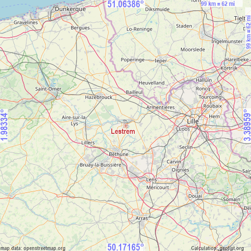
Lestrem GPS coordinates[2]
50° 37' 11.532" North, 2° 41' 11.256" East
| Map corner | latitude | longitude |
|---|---|---|
| Upper-left | 51.06386°, | 1.98334° |
| Center: | 50.61987°, | 2.68646° |
| Lower-right: | 50.17165°, | 3.38959° |
| Map W x H: | 99.2×99.2 km | = 61.6×61.6mi |
| max Lat: | 51.07786° ⇑1.7% North |
| Lestrem: | 50.61987° |
| min Lat: | ⇓98.3% South 41.3874° |
| min Long | Lestrem | max Long |
| -5.08615° | 2.68646° | 9.52242° |
| W 53.2%⇐ | ⇒46.8% E |
Elevation
Elevation of Lestrem is 18 m = 59 ft, and this is 175.7 m = 576 ft below average elevation for this country.
| Max E: |
2333 m = 7654 ft | 94.7% |
| Avg. | 193.7 m = 635 ft | |
| Lestrem | 18 m = 59 ft | |
Min E: |
-1 m = -3 ft | 5.3% |
See also: France elevation on elevation.city.
Geographical zone
Lestrem is located in North temperate zone (between Tropic of Cancer and the Arctic Circle). Distance of this North polar circle is 1772.8 km =1101.6 mi to North.| Distance of | km | miles | from Lestrem |
|---|---|---|---|
| North Pole | 4378.7 | 2720.8 | to North |
| Arctic Circle | 1772.8 | 1101.6 | to North |
| Tropic Cancer | 3022.5 | 1878.1 | to South |
| Equator | 5628.4 | 3497.3 | to South |


Nearby cities:
15 places around Lestrem: (largest is in red/bold)
• Calonne-sur-la-Lys
4.9 km =3 mi,  273°
273°
• Estaires
4.1 km =2.5 mi,  45°
45°
• Hinges
7.5 km =4.7 mi,  217°
217°
• La Couture
4.4 km =2.7 mi,  160°
160°
• La Gorgue
2.8 km =1.7 mi, 45°
• Laventie
6 km =3.7 mi,  81°
81°
• Le Doulieu
7.2 km =4.5 mi,  17°
17°
• Locon
5.7 km =3.5 mi,  194°
194°
• Merville
4.1 km =2.5 mi,  309°
309°
• Neuf-Berquin
4.6 km =2.9 mi,  347°
347°
• Neuve-Chapelle
7.7 km =4.8 mi,  119°
119°
• Richebourg
5.2 km =3.2 mi,  140°
140°
• Richebourg-l'Avoué
7.1 km =4.4 mi, 141°
• Sailly-sur-la-Lys
7.2 km =4.5 mi, 53°
• Vieille-Chapelle
3.4 km =2.1 mi, 162°
Sources, notices
• [Note1] Compared only with cities in France existing in our database
• [Src1] Map data: © OpenStreetMap contributors (CC-BY-SA)
• [Src2] Other city data from geonames.org with taken over terms of usage.
• [Src3] Geographical zone / Annual Mean Temperature by Robert A. Rohde @ Wikipedia
