Vieille-Chapelle geodata
Vieille-Chapelle (Hauts-de-France) is a populated place; located in France in Europe/Paris (GMT+2) time zone. With population of 714 people, there are 11603 cities with bigger population in this country. Compared to other cities in France, 98% of cities are located further ↓South; 53.5% of cities are located further ←West and 94.4% of cities have higher elevation than Vieille-Chapelle. Note1
Administrative division(s):
- Level 1: Hauts-de-France
- Level 2: Pas-de-Calais
- Level 3: Arrondissement de Béthune
- Level 4: Vieille-Chapelle


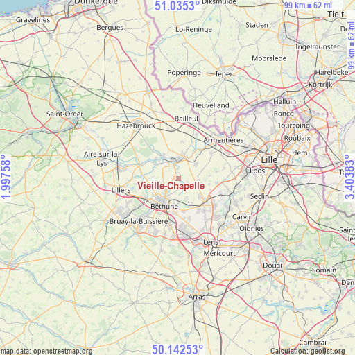
Vieille-Chapelle GPS coordinates[2]
50° 35' 27.708" North, 2° 42' 2.556" East
| Map corner | latitude | longitude |
|---|---|---|
| Upper-left | 51.0353°, | 1.99758° |
| Center: | 50.59103°, | 2.70071° |
| Lower-right: | 50.14253°, | 3.40383° |
| Map W x H: | 99.3×99.3 km | = 61.7×61.7mi |
| max Lat: | 51.07786° ⇑2% North |
| Vieille-Chapelle: | 50.59103° |
| min Lat: | ⇓98% South 41.3874° |
| min Long | Vieille-Chapell | max Long |
| -5.08615° | 2.70071° | 9.52242° |
| W 53.5%⇐ | ⇒46.5% E |
Elevation
Elevation of Vieille-Chapelle is 19 m = 62 ft, and this is 174.7 m = 573 ft below average elevation for this country.
| Max E: |
2333 m = 7654 ft | 94.4% |
| Avg. | 193.7 m = 635 ft | |
| Vieille-Chapelle | 19 m = 62 ft | |
Min E: |
-1 m = -3 ft | 5.6% |
See also: France elevation on elevation.city.
Geographical zone
Vieille-Chapelle is located in North temperate zone (between Tropic of Cancer and the Arctic Circle). Distance of this North polar circle is 1776 km =1103.6 mi to North.| Distance of | km | miles | from Vieille-Chapelle |
|---|---|---|---|
| North Pole | 4381.9 | 2722.8 | to North |
| Arctic Circle | 1776 | 1103.6 | to North |
| Tropic Cancer | 3019.3 | 1876.1 | to South |
| Equator | 5625.2 | 3495.3 | to South |


Nearby cities:
15 places around Vieille-Chapelle: (largest is in red/bold)
• Calonne-sur-la-Lys
6.9 km =4.3 mi,  300°
300°
• Essars
5.3 km =3.3 mi,  207°
207°
• Estaires
6.4 km =4 mi,  17°
17°
• Festubert
5.9 km =3.7 mi,  155°
155°
• Hinges
6.2 km =3.9 mi,  244°
244°
• La Couture
1.1 km =0.7 mi, 155°
• La Gorgue
5.3 km =3.3 mi,  10°
10°
• Laventie
6.4 km =4 mi,  50°
50°
• Lestrem
3.4 km =2.1 mi,  342°
342°
• Locon
3.4 km =2.1 mi,  226°
226°
• Lorgies
6.8 km =4.2 mi,  111°
111°
• Merville
7.2 km =4.5 mi,  324°
324°
• Neuve-Chapelle
5.8 km =3.6 mi,  95°
95°
• Richebourg
2.5 km =1.6 mi, 110°
• Richebourg-l'Avoué
4.1 km =2.5 mi,  124°
124°
Sources, notices
• [Note1] Compared only with cities in France existing in our database
• [Src1] Map data: © OpenStreetMap contributors (CC-BY-SA)
• [Src2] Other city data from geonames.org with taken over terms of usage.
• [Src3] Geographical zone / Annual Mean Temperature by Robert A. Rohde @ Wikipedia
