Hinges geodata
Hinges (Hauts-de-France) is a populated place; located in France in Europe/Paris (GMT+2) time zone. With population of 2,209 people, there are 4351 cities with bigger population in this country. Compared to other cities in France, 97.8% of cities are located further ↓South; 52.4% of cities are located further ←West and 85.3% of cities have higher elevation than Hinges. Note1
Administrative division(s):
- Level 1: Hauts-de-France
- Level 2: Pas-de-Calais
- Level 3: Arrondissement de Béthune
- Level 4: Hinges


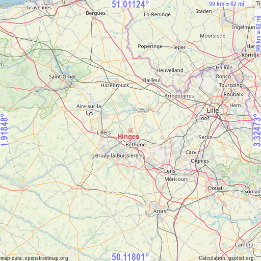
Hinges GPS coordinates[2]
50° 34' 0.264" North, 2° 37' 17.76" East
| Map corner | latitude | longitude |
|---|---|---|
| Upper-left | 51.01124°, | 1.91848° |
| Center: | 50.56674°, | 2.6216° |
| Lower-right: | 50.11801°, | 3.32473° |
| Map W x H: | 99.3×99.3 km | = 61.7×61.7mi |
| max Lat: | 51.07786° ⇑2.2% North |
| Hinges: | 50.56674° |
| min Lat: | ⇓97.8% South 41.3874° |
| min Long | Hinges | max Long |
| -5.08615° | 2.6216° | 9.52242° |
| W 52.4%⇐ | ⇒47.6% E |
Elevation
Elevation of Hinges is 41 m = 135 ft, and this is 152.7 m = 501 ft below average elevation for this country.
| Max E: |
2333 m = 7654 ft | 85.3% |
| Avg. | 193.7 m = 635 ft | |
| Hinges | 41 m = 135 ft | |
Min E: |
-1 m = -3 ft | 14.7% |
See also: France elevation on elevation.city.
Geographical zone
Hinges is located in North temperate zone (between Tropic of Cancer and the Arctic Circle). Distance of this North polar circle is 1778.7 km =1105.2 mi to North.| Distance of | km | miles | from Hinges |
|---|---|---|---|
| North Pole | 4384.6 | 2724.5 | to North |
| Arctic Circle | 1778.7 | 1105.2 | to North |
| Tropic Cancer | 3016.6 | 1874.4 | to South |
| Equator | 5622.5 | 3493.7 | to South |


Nearby cities:
15 places around Hinges: (largest is in red/bold)
• Annezin
3.9 km =2.4 mi,  183°
183°
• Béthune
4.3 km =2.7 mi,  162°
162°
• Calonne-sur-la-Lys
6.3 km =3.9 mi,  356°
356°
• Chocques
4.5 km =2.8 mi,  230°
230°
• Essars
3.7 km =2.3 mi,  122°
122°
• Fouquereuil
5.5 km =3.4 mi,  195°
195°
• Fouquières-lès-Béthune
5.8 km =3.6 mi,  188°
188°
• Gonnehem
3.5 km =2.2 mi,  258°
258°
• La Couture
6.3 km =3.9 mi,  74°
74°
• Labeuvrière
6.7 km =4.2 mi,  218°
218°
• Locon
3.2 km =2 mi,  82°
82°
• Mont-Bernanchon
3.3 km =2.1 mi,  304°
304°
• Robecq
5.3 km =3.3 mi,  308°
308°
• Vendin-lès-Béthune
3.3 km =2.1 mi,  206°
206°
• Vieille-Chapelle
6.2 km =3.9 mi,  64°
64°
Sources, notices
• [Note1] Compared only with cities in France existing in our database
• [Src1] Map data: © OpenStreetMap contributors (CC-BY-SA)
• [Src2] Other city data from geonames.org with taken over terms of usage.
• [Src3] Geographical zone / Annual Mean Temperature by Robert A. Rohde @ Wikipedia
