Neuve-Chapelle geodata
Neuve-Chapelle (Hauts-de-France) is a populated place; located in France in Europe/Paris (GMT+2) time zone. With population of 978 people, there are 8995 cities with bigger population in this country. Compared to other cities in France, 98% of cities are located further ↓South; 54.7% of cities are located further ←West and 94.4% of cities have higher elevation than Neuve-Chapelle. Note1
Administrative division(s):
- Level 1: Hauts-de-France
- Level 2: Pas-de-Calais
- Level 3: Arrondissement de Béthune
- Level 4: Neuve-Chapelle


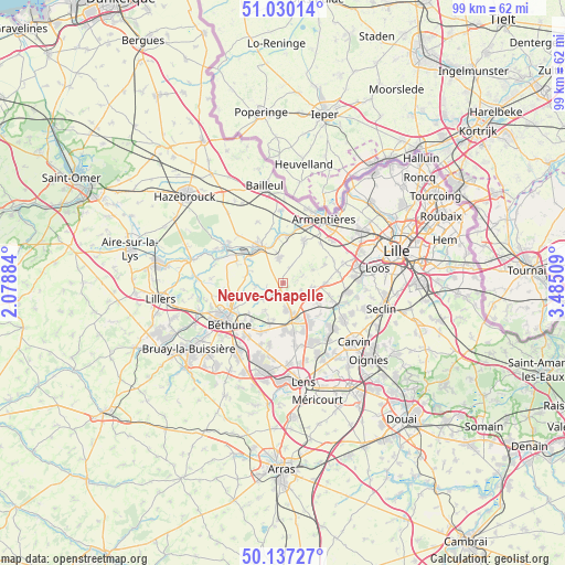
Neuve-Chapelle GPS coordinates[2]
50° 35' 8.952" North, 2° 46' 55.056" East
| Map corner | latitude | longitude |
|---|---|---|
| Upper-left | 51.03014°, | 2.07884° |
| Center: | 50.58582°, | 2.78196° |
| Lower-right: | 50.13727°, | 3.48509° |
| Map W x H: | 99.3×99.3 km | = 61.7×61.7mi |
| max Lat: | 51.07786° ⇑2% North |
| Neuve-Chapelle: | 50.58582° |
| min Lat: | ⇓98% South 41.3874° |
| min Long | Neuve-Chapelle | max Long |
| -5.08615° | 2.78196° | 9.52242° |
| W 54.7%⇐ | ⇒45.3% E |
Elevation
Elevation of Neuve-Chapelle is 19 m = 62 ft, and this is 174.7 m = 573 ft below average elevation for this country.
| Max E: |
2333 m = 7654 ft | 94.4% |
| Avg. | 193.7 m = 635 ft | |
| Neuve-Chapelle | 19 m = 62 ft | |
Min E: |
-1 m = -3 ft | 5.6% |
See also: France elevation on elevation.city.
Geographical zone
Neuve-Chapelle is located in North temperate zone (between Tropic of Cancer and the Arctic Circle). Distance of this North polar circle is 1776.6 km =1103.9 mi to North.| Distance of | km | miles | from Neuve-Chapelle |
|---|---|---|---|
| North Pole | 4382.4 | 2723.1 | to North |
| Arctic Circle | 1776.6 | 1103.9 | to North |
| Tropic Cancer | 3018.7 | 1875.7 | to South |
| Equator | 5624.6 | 3495 | to South |


Nearby cities:
15 places around Neuve-Chapelle: (largest is in red/bold)
• Aubers
3.3 km =2.1 mi,  71°
71°
• Festubert
5.8 km =3.6 mi,  214°
214°
• Fromelles
5.6 km =3.5 mi,  64°
64°
• Herlies
5.1 km =3.2 mi,  100°
100°
• Illies
4.3 km =2.7 mi,  128°
128°
• La Bassée
6 km =3.7 mi,  163°
163°
• La Couture
5.3 km =3.3 mi,  265°
265°
• Laventie
4.8 km =3 mi,  350°
350°
• Lorgies
2 km =1.2 mi, 162°
• Marquillies
7.1 km =4.4 mi,  118°
118°
• Richebourg
3.4 km =2.1 mi, 265°
• Richebourg-l'Avoué
2.9 km =1.8 mi,  233°
233°
• Salomé
7.4 km =4.6 mi,  141°
141°
• Vieille-Chapelle
5.8 km =3.6 mi,  275°
275°
• Violaines
4.9 km =3 mi,  174°
174°
Sources, notices
• [Note1] Compared only with cities in France existing in our database
• [Src1] Map data: © OpenStreetMap contributors (CC-BY-SA)
• [Src2] Other city data from geonames.org with taken over terms of usage.
• [Src3] Geographical zone / Annual Mean Temperature by Robert A. Rohde @ Wikipedia
