Richebourg-l'Avoué geodata
Richebourg-l'Avoué (Hauts-de-France) is a populated place; located in France in Europe/Paris (GMT+2) time zone. With population of 2,560 people, there are 3806 cities with bigger population in this country. Compared to other cities in France, 97.9% of cities are located further ↓South; 54.2% of cities are located further ←West and 94.7% of cities have higher elevation than Richebourg-l'Avoué. Note1
Administrative division(s):
- Level 1: Hauts-de-France
- Level 2: Pas-de-Calais
- Level 3: Arrondissement de Béthune
- Level 4: Richebourg


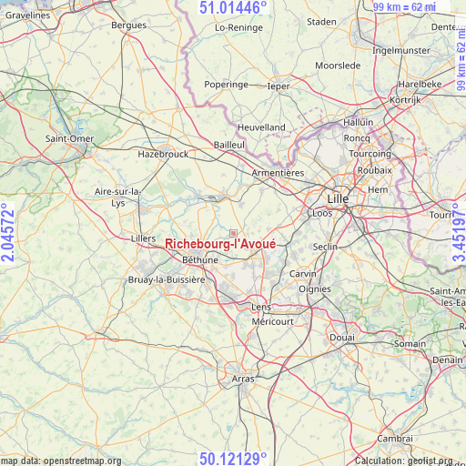
Richebourg-l'Avoué GPS coordinates[2]
50° 34' 11.964" North, 2° 44' 55.824" East
| Map corner | latitude | longitude |
|---|---|---|
| Upper-left | 51.01446°, | 2.04572° |
| Center: | 50.56999°, | 2.74884° |
| Lower-right: | 50.12129°, | 3.45197° |
| Map W x H: | 99.3×99.3 km | = 61.7×61.7mi |
| max Lat: | 51.07786° ⇑2.1% North |
| Richebourg-l'Avoué: | 50.56999° |
| min Lat: | ⇓97.9% South 41.3874° |
| min Long | Richebourg-l'Av | max Long |
| -5.08615° | 2.74884° | 9.52242° |
| W 54.2%⇐ | ⇒45.8% E |
Elevation
Elevation of Richebourg-l'Avoué is 18 m = 59 ft, and this is 175.7 m = 576 ft below average elevation for this country.
| Max E: |
2333 m = 7654 ft | 94.7% |
| Avg. | 193.7 m = 635 ft | |
| Richebourg-l'Avoué | 18 m = 59 ft | |
Min E: |
-1 m = -3 ft | 5.3% |
See also: France elevation on elevation.city.
Geographical zone
Richebourg-l'Avoué is located in North temperate zone (between Tropic of Cancer and the Arctic Circle). Distance of this North polar circle is 1778.3 km =1105 mi to North.| Distance of | km | miles | from Richebourg-l'Avoué |
|---|---|---|---|
| North Pole | 4384.2 | 2724.2 | to North |
| Arctic Circle | 1778.3 | 1105 | to North |
| Tropic Cancer | 3016.9 | 1874.6 | to South |
| Equator | 5622.9 | 3493.9 | to South |


Nearby cities:
15 places around Richebourg-l'Avoué: (largest is in red/bold)
• Aubers
6.2 km =3.9 mi,  62°
62°
• Auchy-les-Mines
6.7 km =4.2 mi,  159°
159°
• Cuinchy
5.8 km =3.6 mi,  180°
180°
• Essars
6.3 km =3.9 mi,  247°
247°
• Festubert
3.2 km =2 mi,  196°
196°
• Illies
5.8 km =3.6 mi,  99°
99°
• La Bassée
5.7 km =3.5 mi,  134°
134°
• La Couture
3.2 km =2 mi,  294°
294°
• Laventie
6.7 km =4.2 mi,  13°
13°
• Locon
5.8 km =3.6 mi,  270°
270°
• Lorgies
2.9 km =1.8 mi,  92°
92°
• Neuve-Chapelle
2.9 km =1.8 mi,  53°
53°
• Richebourg
1.8 km =1.1 mi,  323°
323°
• Vieille-Chapelle
4.1 km =2.5 mi,  304°
304°
• Violaines
4.2 km =2.6 mi,  138°
138°
Sources, notices
• [Note1] Compared only with cities in France existing in our database
• [Src1] Map data: © OpenStreetMap contributors (CC-BY-SA)
• [Src2] Other city data from geonames.org with taken over terms of usage.
• [Src3] Geographical zone / Annual Mean Temperature by Robert A. Rohde @ Wikipedia
