Le Rouget geodata
Le Rouget (Auvergne-Rhône-Alpes) is a populated place; located in France in Europe/Paris (GMT+2) time zone. With population of 912 people, there are 9558 cities with bigger population in this country. Compared to other cities in France, 80.9% of cities are located further ↑North; 53.9% of cities are located further →East and 95.1% of cities have lower elevation than Le Rouget. Note1
Administrative division(s):
- Level 1: Auvergne-Rhône-Alpes
- Level 2: Cantal
- Level 3: Aurillac
- Level 4: Le Rouget-Pers


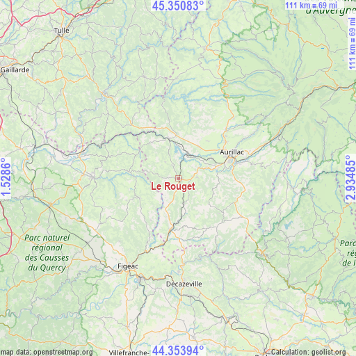
Le Rouget GPS coordinates[2]
44° 51' 16.344" North, 2° 13' 54.192" East
| Map corner | latitude | longitude |
|---|---|---|
| Upper-left | 45.35083°, | 1.5286° |
| Center: | 44.85454°, | 2.23172° |
| Lower-right: | 44.35394°, | 2.93485° |
| Map W x H: | 110.8×110.8 km | = 68.8×68.8mi |
| max Lat: | 51.07786° ⇑80.9% North |
| Le Rouget: | 44.85454° |
| min Lat: | ⇓19.1% South 41.3874° |
| min Long | Le Rouget | max Long |
| -5.08615° | 2.23172° | 9.52242° |
| W 46.1%⇐ | ⇒53.9% E |
Elevation
Elevation of Le Rouget is 592 m = 1942 ft, and this is 398.3 m = 1307 ft above average elevation for this country.
| Max E: |
2333 m = 7654 ft | 4.9% |
| Le Rouget | 592 m 1942 ft | |
| Avg. | 193.7 m = 635 ft | |
Min E: |
-1 m = -3 ft | 95.1% |
See also: France elevation on elevation.city.
Geographical zone
Le Rouget is located in North temperate zone (between Tropic of Cancer and the Arctic Circle). Distance of this Northern Tropic circle is 2381.4 km =1479.7 mi to South.| Distance of | km | miles | from Le Rouget |
|---|---|---|---|
| North Pole | 5019.7 | 3119.1 | to North |
| Arctic Circle | 2413.8 | 1499.9 | to North |
| Tropic Cancer | 2381.4 | 1479.7 | to South |
| Equator | 4987.4 | 3099 | to South |


Nearby cities:
15 places around Le Rouget: (largest is in red/bold)
• Aurillac
18.2 km =11.3 mi,  64°
64°
• Ayrens
16.3 km =10.1 mi,  27°
27°
• Boisset
8.2 km =5.1 mi,  167°
167°
• Laroquebrou
13.1 km =8.1 mi,  345°
345°
• Latronquière
13.6 km =8.5 mi,  243°
243°
• Marcolès
12.5 km =7.8 mi,  130°
130°
• Maurs
16.2 km =10.1 mi,  189°
189°
• Roannes-Saint-Mary
12.5 km =7.8 mi,  88°
88°
• Saint-Mamet-la-Salvetat
5.9 km =3.7 mi, 86°
• Saint-Paul-des-Landes
11.8 km =7.3 mi, 33°
• Saint-Étienne-de-Maurs
15.5 km =9.6 mi, 187°
• Sansac-de-Marmiesse
9.7 km =6 mi,  70°
70°
• Siran
13.8 km =8.6 mi,  323°
323°
• Sousceyrac
15.6 km =9.7 mi,  277°
277°
• Ytrac
12.1 km =7.5 mi, 58°
Sources, notices
• [Note1] Compared only with cities in France existing in our database
• [Src1] Map data: © OpenStreetMap contributors (CC-BY-SA)
• [Src2] Other city data from geonames.org with taken over terms of usage.
• [Src3] Geographical zone / Annual Mean Temperature by Robert A. Rohde @ Wikipedia
