Le Poiré-sur-Vie geodata
Le Poiré-sur-Vie (Pays de la Loire) is a populated place; located in France in Europe/Paris (GMT+2) time zone. With population of 6,273 people, there are 1582 cities with bigger population in this country. Compared to other cities in France, 57.5% of cities are located further ↑North; 92.3% of cities are located further →East and 78.6% of cities have higher elevation than Le Poiré-sur-Vie. Note1
Administrative division(s):
- Level 1: Pays de la Loire
- Level 2: Département de la Vendée
- Level 3: Arrondissement de La Roche-sur-Yon
- Level 4: Le Poiré-sur-Vie


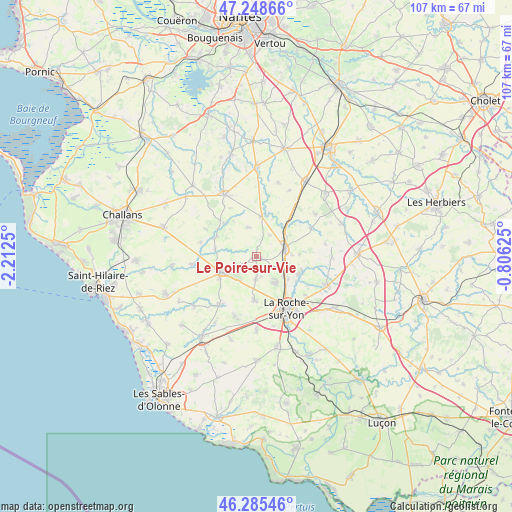
Le Poiré-sur-Vie GPS coordinates[2]
46° 46' 9.156" North, 1° 30' 33.768" West
| Map corner | latitude | longitude |
|---|---|---|
| Upper-left | 47.24866°, | -2.2125° |
| Center: | 46.76921°, | -1.50938° |
| Lower-right: | 46.28546°, | -0.80625° |
| Map W x H: | 107.1×107.1 km | = 66.5×66.5mi |
| max Lat: | 51.07786° ⇑57.5% North |
| Le Poiré-sur-Vie: | 46.76921° |
| min Lat: | ⇓42.5% South 41.3874° |
| min Long | Le Poiré-sur-V | max Long |
| -5.08615° | -1.50938° | 9.52242° |
| W 7.7%⇐ | ⇒92.3% E |
Elevation
Elevation of Le Poiré-sur-Vie is 58 m = 190 ft, and this is 135.7 m = 445 ft below average elevation for this country.
| Max E: |
2333 m = 7654 ft | 78.6% |
| Avg. | 193.7 m = 635 ft | |
| Le Poiré-sur-Vie | 58 m = 190 ft | |
Min E: |
-1 m = -3 ft | 21.4% |
See also: France elevation on elevation.city.
Geographical zone
Le Poiré-sur-Vie is located in North temperate zone (between Tropic of Cancer and the Arctic Circle). Distance of this North polar circle is 2200.9 km =1367.6 mi to North.| Distance of | km | miles | from Le Poiré-sur-Vie |
|---|---|---|---|
| North Pole | 4806.8 | 2986.8 | to North |
| Arctic Circle | 2200.9 | 1367.6 | to North |
| Tropic Cancer | 2594.3 | 1612 | to South |
| Equator | 5200.2 | 3231.3 | to South |


Nearby cities:
15 places around Le Poiré-sur-Vie: (largest is in red/bold)
• Aizenay
8.2 km =5.1 mi,  246°
246°
• Beaulieu-sous-la-Roche
12.9 km =8 mi,  216°
216°
• Belleville-sur-Vie
6.3 km =3.9 mi,  75°
75°
• Dompierre-sur-Yon
10.1 km =6.3 mi,  109°
109°
• La Chapelle-Palluau
8.7 km =5.4 mi,  279°
279°
• La Génétouze
4 km =2.5 mi,  187°
187°
• La Roche-sur-Yon
12.8 km =8 mi,  153°
153°
• Les Lucs-sur-Boulogne
8.5 km =5.3 mi,  7°
7°
• Mouilleron-le-Captif
7 km =4.3 mi,  143°
143°
• Palluau
9.3 km =5.8 mi,  295°
295°
• Saint-Denis-la-Chevasse
13 km =8.1 mi,  62°
62°
• Saint-Paul-Mont-Penit
12.1 km =7.5 mi, 284°
• Saint-Étienne-du-Bois
9.5 km =5.9 mi,  315°
315°
• Saligny
7.6 km =4.7 mi, 55°
• Venansault
9.4 km =5.8 mi,  182°
182°
Sources, notices
• [Note1] Compared only with cities in France existing in our database
• [Src1] Map data: © OpenStreetMap contributors (CC-BY-SA)
• [Src2] Other city data from geonames.org with taken over terms of usage.
• [Src3] Geographical zone / Annual Mean Temperature by Robert A. Rohde @ Wikipedia
