Saint-Paul-Mont-Penit geodata
Saint-Paul-Mont-Penit (Pays de la Loire) is a populated place; located in France in Europe/Paris (GMT+2) time zone. With population of 518 people, there are 14866 cities with bigger population in this country. Compared to other cities in France, 57.2% of cities are located further ↑North; 93.3% of cities are located further →East and 85.3% of cities have higher elevation than Saint-Paul-Mont-Penit. Note1
Administrative division(s):
- Level 1: Pays de la Loire
- Level 2: Département de la Vendée
- Level 3: Arrondissement de La Roche-sur-Yon
- Level 4: Saint-Paul-Mont-Penit
Current local time in Saint-Paul-Mont-Penit:
03:47 PM, SaturdayDifference from your time zone: hours


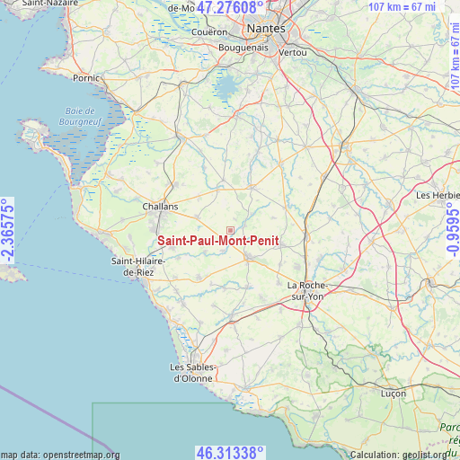
Saint-Paul-Mont-Penit GPS coordinates[2]
46° 47' 48.768" North, 1° 39' 45.432" West
| Map corner | latitude | longitude |
|---|---|---|
| Upper-left | 47.27608°, | -2.36575° |
| Center: | 46.79688°, | -1.66262° |
| Lower-right: | 46.31338°, | -0.9595° |
| Map W x H: | 107×107 km | = 66.5×66.5mi |
| max Lat: | 51.07786° ⇑57.2% North |
| Saint-Paul-Mont-Penit: | 46.79688° |
| min Lat: | ⇓42.8% South 41.3874° |
| min Long | Saint-Paul-Mont | max Long |
| -5.08615° | -1.66262° | 9.52242° |
| W 6.7%⇐ | ⇒93.3% E |
Elevation
Elevation of Saint-Paul-Mont-Penit is 41 m = 135 ft, and this is 152.7 m = 501 ft below average elevation for this country.
| Max E: |
2333 m = 7654 ft | 85.3% |
| Avg. | 193.7 m = 635 ft | |
| Saint-Paul-Mont-Penit | 41 m = 135 ft | |
Min E: |
-1 m = -3 ft | 14.7% |
See also: France elevation on elevation.city.
Geographical zone
Saint-Paul-Mont-Penit is located in North temperate zone (between Tropic of Cancer and the Arctic Circle). Distance of this North polar circle is 2197.8 km =1365.6 mi to North.| Distance of | km | miles | from Saint-Paul-Mont-Penit |
|---|---|---|---|
| North Pole | 4803.7 | 2984.9 | to North |
| Arctic Circle | 2197.8 | 1365.6 | to North |
| Tropic Cancer | 2597.4 | 1613.9 | to South |
| Equator | 5203.3 | 3233.2 | to South |


Nearby cities:
15 places around Saint-Paul-Mont-Penit: (largest is in red/bold)
• Aizenay
7.6 km =4.7 mi,  146°
146°
• Apremont
8 km =5 mi,  227°
227°
• Coëx
13.2 km =8.2 mi,  213°
213°
• Falleron
9.9 km =6.2 mi,  342°
342°
• Froidfond
10.8 km =6.7 mi,  318°
318°
• La Chapelle-Hermier
13.5 km =8.4 mi,  199°
199°
• La Chapelle-Palluau
3.5 km =2.2 mi,  117°
117°
• La Génétouze
13.2 km =8.2 mi, 122°
• Le Poiré-sur-Vie
12.1 km =7.5 mi,  104°
104°
• Legé
10.8 km =6.7 mi,  25°
25°
• Maché
5.1 km =3.2 mi, 201°
• Palluau
3.4 km =2.1 mi,  75°
75°
• Saint-Christophe-du-Ligneron
8.4 km =5.2 mi,  291°
291°
• Saint-Étienne-du-Bois
6.2 km =3.9 mi,  53°
53°
• Touvois
11.8 km =7.3 mi,  352°
352°
Sources, notices
• [Note1] Compared only with cities in France existing in our database
• [Src1] Map data: © OpenStreetMap contributors (CC-BY-SA)
• [Src2] Other city data from geonames.org with taken over terms of usage.
• [Src3] Geographical zone / Annual Mean Temperature by Robert A. Rohde @ Wikipedia
