Le Plessis-Grammoire geodata
Le Plessis-Grammoire (Pays de la Loire) is a populated place; located in France in Europe/Paris (GMT+2) time zone. With population of 2,123 people, there are 4536 cities with bigger population in this country. Compared to other cities in France, 51.1% of cities are located further ↓South; 82.5% of cities are located further →East and 87.1% of cities have higher elevation than Le Plessis-Grammoire. Note1
Administrative division(s):
- Level 1: Pays de la Loire
- Level 2: Département de Maine-et-Loire
- Level 3: Angers
- Level 4: Le Plessis-Grammoire


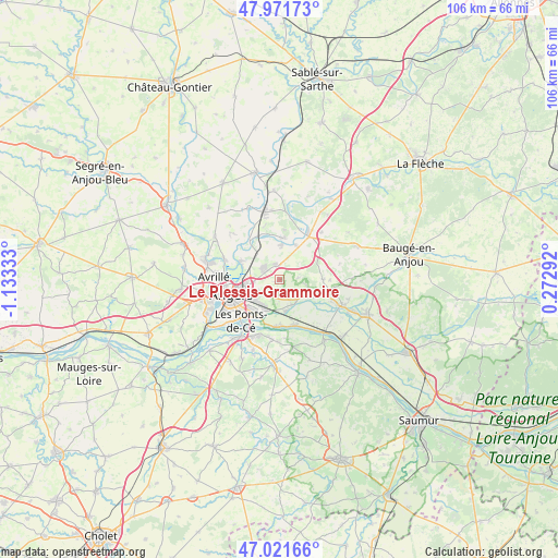
Le Plessis-Grammoire GPS coordinates[2]
47° 29' 55.824" North, 0° 25' 48.756" West
| Map corner | latitude | longitude |
|---|---|---|
| Upper-left | 47.97173°, | -1.13333° |
| Center: | 47.49884°, | -0.43021° |
| Lower-right: | 47.02166°, | 0.27292° |
| Map W x H: | 105.6×105.6 km | = 65.6×65.6mi |
| max Lat: | 51.07786° ⇑48.9% North |
| Le Plessis-Grammoire: | 47.49884° |
| min Lat: | ⇓51.1% South 41.3874° |
| min Long | Le Plessis-Gram | max Long |
| -5.08615° | -0.43021° | 9.52242° |
| W 17.5%⇐ | ⇒82.5% E |
Elevation
Elevation of Le Plessis-Grammoire is 37 m = 121 ft, and this is 156.7 m = 514 ft below average elevation for this country.
| Max E: |
2333 m = 7654 ft | 87.1% |
| Avg. | 193.7 m = 635 ft | |
| Le Plessis-Grammoire | 37 m = 121 ft | |
Min E: |
-1 m = -3 ft | 12.9% |
See also: France elevation on elevation.city.
Geographical zone
Le Plessis-Grammoire is located in North temperate zone (between Tropic of Cancer and the Arctic Circle). Distance of this North polar circle is 2119.8 km =1317.2 mi to North.| Distance of | km | miles | from Le Plessis-Grammoire |
|---|---|---|---|
| North Pole | 4725.7 | 2936.4 | to North |
| Arctic Circle | 2119.8 | 1317.2 | to North |
| Tropic Cancer | 2675.5 | 1662.5 | to South |
| Equator | 5281.4 | 3281.7 | to South |


Nearby cities:
15 places around Le Plessis-Grammoire: (largest is in red/bold)
• Andard
5.3 km =3.3 mi,  152°
152°
• Angers
9.3 km =5.8 mi,  252°
252°
• Bauné
8.3 km =5.2 mi,  89°
89°
• Briollay
9.3 km =5.8 mi,  321°
321°
• Corné
6.8 km =4.2 mi,  117°
117°
• Corzé
7.4 km =4.6 mi,  23°
23°
• La Bohalle
9 km =5.6 mi,  164°
164°
• La Daguenière
8.8 km =5.5 mi,  180°
180°
• Pellouailles-les-Vignes
2.6 km =1.6 mi,  344°
344°
• Sarrigné
3.5 km =2.2 mi,  83°
83°
• Seiches-sur-le-Loir
10 km =6.2 mi,  33°
33°
• Soucelles
7.8 km =4.8 mi,  6°
6°
• Trélazé
6.5 km =4 mi,  204°
204°
• Villevêque
6.9 km =4.3 mi,  3°
3°
• Écouflant
8.2 km =5.1 mi,  296°
296°
Sources, notices
• [Note1] Compared only with cities in France existing in our database
• [Src1] Map data: © OpenStreetMap contributors (CC-BY-SA)
• [Src2] Other city data from geonames.org with taken over terms of usage.
• [Src3] Geographical zone / Annual Mean Temperature by Robert A. Rohde @ Wikipedia
