Bauné geodata
Bauné (Pays de la Loire) is a populated place; located in France in Europe/Paris (GMT+2) time zone. With population of 1,384 people, there are 6668 cities with bigger population in this country. Compared to other cities in France, 51.2% of cities are located further ↓South; 81.1% of cities are located further →East and 90.3% of cities have higher elevation than Bauné. Note1
Administrative division(s):
- Level 1: Pays de la Loire
- Level 2: Département de Maine-et-Loire
- Level 3: Angers
- Level 4: Loire-Authion


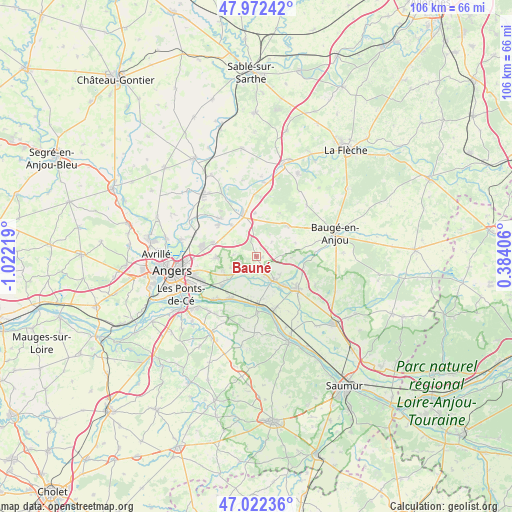
Bauné GPS coordinates[2]
47° 29' 58.344" North, 0° 19' 8.616" West
| Map corner | latitude | longitude |
|---|---|---|
| Upper-left | 47.97242°, | -1.02219° |
| Center: | 47.49954°, | -0.31906° |
| Lower-right: | 47.02236°, | 0.38406° |
| Map W x H: | 105.6×105.6 km | = 65.6×65.6mi |
| max Lat: | 51.07786° ⇑48.8% North |
| Bauné: | 47.49954° |
| min Lat: | ⇓51.2% South 41.3874° |
| min Long | Bauné | max Long |
| -5.08615° | -0.31906° | 9.52242° |
| W 18.9%⇐ | ⇒81.1% E |
Elevation
Elevation of Bauné is 29 m = 95 ft, and this is 164.7 m = 540 ft below average elevation for this country.
| Max E: |
2333 m = 7654 ft | 90.3% |
| Avg. | 193.7 m = 635 ft | |
| Bauné | 29 m = 95 ft | |
Min E: |
-1 m = -3 ft | 9.7% |
See also: France elevation on elevation.city.
Geographical zone
Bauné is located in North temperate zone (between Tropic of Cancer and the Arctic Circle). Distance of this North polar circle is 2119.7 km =1317.1 mi to North.| Distance of | km | miles | from Bauné |
|---|---|---|---|
| North Pole | 4725.6 | 2936.4 | to North |
| Arctic Circle | 2119.7 | 1317.1 | to North |
| Tropic Cancer | 2675.5 | 1662.5 | to South |
| Equator | 5281.5 | 3281.8 | to South |


Nearby cities:
15 places around Bauné: (largest is in red/bold)
• Andard
7.6 km =4.7 mi,  230°
230°
• Beaufort-en-Vallée
10.1 km =6.3 mi,  131°
131°
• Corné
3.9 km =2.4 mi,  216°
216°
• Corzé
8.6 km =5.3 mi,  321°
321°
• Fontaine-Guérin
9.9 km =6.2 mi,  98°
98°
• Jarzé
9 km =5.6 mi,  46°
46°
• La Bohalle
10.5 km =6.5 mi,  213°
213°
• Le Plessis-Grammoire
8.3 km =5.2 mi,  269°
269°
• Mazé
6 km =3.7 mi,  143°
143°
• Pellouailles-les-Vignes
9.4 km =5.8 mi,  285°
285°
• Saint-Mathurin-sur-Loire
9.2 km =5.7 mi,  178°
178°
• Sarrigné
4.8 km =3 mi, 273°
• Seiches-sur-le-Loir
8.7 km =5.4 mi,  341°
341°
• Soucelles
10.7 km =6.6 mi, 315°
• Villevêque
10.4 km =6.5 mi,  310°
310°
Sources, notices
• [Note1] Compared only with cities in France existing in our database
• [Src1] Map data: © OpenStreetMap contributors (CC-BY-SA)
• [Src2] Other city data from geonames.org with taken over terms of usage.
• [Src3] Geographical zone / Annual Mean Temperature by Robert A. Rohde @ Wikipedia
