Seiches-sur-le-Loir geodata
Seiches-sur-le-Loir (Pays de la Loire) is a populated place; located in France in Europe/Paris (GMT+2) time zone. With population of 2,537 people, there are 3842 cities with bigger population in this country. Compared to other cities in France, 52.3% of cities are located further ↓South; 81.5% of cities are located further →East and 90.7% of cities have higher elevation than Seiches-sur-le-Loir. Note1
Administrative division(s):
- Level 1: Pays de la Loire
- Level 2: Département de Maine-et-Loire
- Level 3: Angers
- Level 4: Seiches-sur-le-Loir


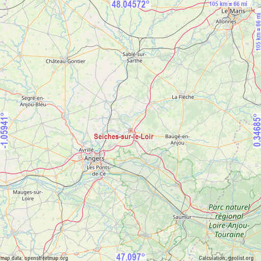
Seiches-sur-le-Loir GPS coordinates[2]
47° 34' 24.636" North, 0° 21' 22.608" West
| Map corner | latitude | longitude |
|---|---|---|
| Upper-left | 48.04572°, | -1.05941° |
| Center: | 47.57351°, | -0.35628° |
| Lower-right: | 47.097°, | 0.34685° |
| Map W x H: | 105.5×105.5 km | = 65.6×65.6mi |
| max Lat: | 51.07786° ⇑47.7% North |
| Seiches-sur-le-Loir: | 47.57351° |
| min Lat: | ⇓52.3% South 41.3874° |
| min Long | Seiches-sur-le- | max Long |
| -5.08615° | -0.35628° | 9.52242° |
| W 18.5%⇐ | ⇒81.5% E |
Elevation
Elevation of Seiches-sur-le-Loir is 28 m = 92 ft, and this is 165.7 m = 544 ft below average elevation for this country.
| Max E: |
2333 m = 7654 ft | 90.7% |
| Avg. | 193.7 m = 635 ft | |
| Seiches-sur-le-Loir | 28 m = 92 ft | |
Min E: |
-1 m = -3 ft | 9.3% |
See also: France elevation on elevation.city.
Geographical zone
Seiches-sur-le-Loir is located in North temperate zone (between Tropic of Cancer and the Arctic Circle). Distance of this North polar circle is 2111.5 km =1312 mi to North.| Distance of | km | miles | from Seiches-sur-le-Loir |
|---|---|---|---|
| North Pole | 4717.4 | 2931.3 | to North |
| Arctic Circle | 2111.5 | 1312 | to North |
| Tropic Cancer | 2683.8 | 1667.6 | to South |
| Equator | 5289.7 | 3286.9 | to South |


Nearby cities:
15 places around Seiches-sur-le-Loir: (largest is in red/bold)
• Bauné
8.7 km =5.4 mi,  161°
161°
• Briollay
11.3 km =7 mi,  265°
265°
• Cheffes
11.8 km =7.3 mi,  294°
294°
• Cheviré-le-Rouge
13.3 km =8.3 mi,  79°
79°
• Corné
11.4 km =7.1 mi,  177°
177°
• Corzé
3 km =1.9 mi,  238°
238°
• Jarzé
9.5 km =5.9 mi,  102°
102°
• Le Plessis-Grammoire
10 km =6.2 mi,  213°
213°
• Lézigné
8.3 km =5.2 mi,  32°
32°
• Pellouailles-les-Vignes
8.5 km =5.3 mi,  227°
227°
• Sarrigné
8.2 km =5.1 mi,  194°
194°
• Soucelles
4.7 km =2.9 mi,  263°
263°
• Tiercé
9.5 km =5.9 mi,  299°
299°
• Villevêque
5.3 km =3.3 mi,  254°
254°
• Étriché
10.8 km =6.7 mi,  322°
322°
Sources, notices
• [Note1] Compared only with cities in France existing in our database
• [Src1] Map data: © OpenStreetMap contributors (CC-BY-SA)
• [Src2] Other city data from geonames.org with taken over terms of usage.
• [Src3] Geographical zone / Annual Mean Temperature by Robert A. Rohde @ Wikipedia
