Le Mayet-de-Montagne geodata
Le Mayet-de-Montagne (Auvergne-Rhône-Alpes) is a populated place; located in France in Europe/Paris (GMT+2) time zone. With population of 1,457 people, there are 6342 cities with bigger population in this country. Compared to other cities in France, 65.5% of cities are located further ↑North; 65.5% of cities are located further ←West and 93.9% of cities have lower elevation than Le Mayet-de-Montagne. Note1
Administrative division(s):
- Level 1: Auvergne-Rhône-Alpes
- Level 2: Département de l'Allier
- Level 3: Arrondissement de Vichy
- Level 4: Le Mayet-de-Montagne
Current local time in Le Mayet-de-Montagne:
03:15 PM, WednesdayDifference from your time zone: hours


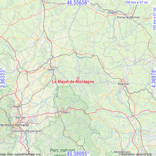
Le Mayet-de-Montagne GPS coordinates[2]
46° 4' 15.276" North, 3° 39' 59.94" East
| Map corner | latitude | longitude |
|---|---|---|
| Upper-left | 46.55656°, | 2.96353° |
| Center: | 46.07091°, | 3.66665° |
| Lower-right: | 45.58095°, | 4.36978° |
| Map W x H: | 108.5×108.5 km | = 67.4×67.4mi |
| max Lat: | 51.07786° ⇑65.5% North |
| Le Mayet-de-Montagne: | 46.07091° |
| min Lat: | ⇓34.5% South 41.3874° |
| min Long | Le Mayet-de-Mon | max Long |
| -5.08615° | 3.66665° | 9.52242° |
| W 65.5%⇐ | ⇒34.5% E |
Elevation
Elevation of Le Mayet-de-Montagne is 540 m = 1772 ft, and this is 346.3 m = 1136 ft above average elevation for this country.
| Max E: |
2333 m = 7654 ft | 6.1% |
| Le Mayet-de-Montagne | 540 m 1772 ft | |
| Avg. | 193.7 m = 635 ft | |
Min E: |
-1 m = -3 ft | 93.9% |
See also: France elevation on elevation.city.
Geographical zone
Le Mayet-de-Montagne is located in North temperate zone (between Tropic of Cancer and the Arctic Circle). Distance of this North polar circle is 2278.6 km =1415.9 mi to North.| Distance of | km | miles | from Le Mayet-de-Montagne |
|---|---|---|---|
| North Pole | 4884.5 | 3035.1 | to North |
| Arctic Circle | 2278.6 | 1415.9 | to North |
| Tropic Cancer | 2516.7 | 1563.8 | to South |
| Equator | 5122.6 | 3183 | to South |


Nearby cities:
15 places around Le Mayet-de-Montagne: (largest is in red/bold)
• Abrest
17.4 km =10.8 mi,  280°
280°
• Ambierle
17.9 km =11.1 mi,  77°
77°
• Arfeuilles
10.6 km =6.6 mi,  26°
26°
• Busset
11.9 km =7.4 mi,  265°
265°
• Châteldon
15.4 km =9.6 mi,  227°
227°
• Cusset
17.7 km =11 mi,  293°
293°
• Ferrières-sur-Sichon
5.2 km =3.2 mi,  195°
195°
• Hauterive
17.1 km =10.6 mi, 276°
• Mariol
14.2 km =8.8 mi,  246°
246°
• Molles
9.5 km =5.9 mi,  298°
298°
• Ris
14.8 km =9.2 mi,  237°
237°
• Saint-Martin-d’Estréaux
17.9 km =11.1 mi, 34°
• Saint-Priest-Bramefant
18 km =11.2 mi, 254°
• Saint-Prix
17.9 km =11.1 mi,  356°
356°
• Saint-Yorre
15.6 km =9.7 mi, 267°
Sources, notices
• [Note1] Compared only with cities in France existing in our database
• [Src1] Map data: © OpenStreetMap contributors (CC-BY-SA)
• [Src2] Other city data from geonames.org with taken over terms of usage.
• [Src3] Geographical zone / Annual Mean Temperature by Robert A. Rohde @ Wikipedia
