Arfeuilles geodata
Arfeuilles (Auvergne-Rhône-Alpes) is a populated place; located in France in Europe/Paris (GMT+2) time zone. With population of 719 people, there are 11547 cities with bigger population in this country. Compared to other cities in France, 64.2% of cities are located further ↑North; 65.9% of cities are located further ←West and 93.2% of cities have lower elevation than Arfeuilles. Note1
Administrative division(s):
- Level 1: Auvergne-Rhône-Alpes
- Level 2: Département de l'Allier
- Level 3: Arrondissement de Vichy
- Level 4: Arfeuilles


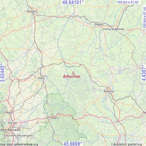
Arfeuilles GPS coordinates[2]
46° 9' 21.996" North, 3° 43' 39.288" East
| Map corner | latitude | longitude |
|---|---|---|
| Upper-left | 46.64101°, | 3.02445° |
| Center: | 46.15611°, | 3.72758° |
| Lower-right: | 45.6669°, | 4.4307° |
| Map W x H: | 108.3×108.3 km | = 67.3×67.3mi |
| max Lat: | 51.07786° ⇑64.2% North |
| Arfeuilles: | 46.15611° |
| min Lat: | ⇓35.8% South 41.3874° |
| min Long | Arfeuilles | max Long |
| -5.08615° | 3.72758° | 9.52242° |
| W 65.9%⇐ | ⇒34.1% E |
Elevation
Elevation of Arfeuilles is 513 m = 1683 ft, and this is 319.3 m = 1048 ft above average elevation for this country.
| Max E: |
2333 m = 7654 ft | 6.8% |
| Arfeuilles | 513 m 1683 ft | |
| Avg. | 193.7 m = 635 ft | |
Min E: |
-1 m = -3 ft | 93.2% |
See also: France elevation on elevation.city.
Geographical zone
Arfeuilles is located in North temperate zone (between Tropic of Cancer and the Arctic Circle). Distance of this North polar circle is 2269.1 km =1410 mi to North.| Distance of | km | miles | from Arfeuilles |
|---|---|---|---|
| North Pole | 4875 | 3029.2 | to North |
| Arctic Circle | 2269.1 | 1410 | to North |
| Tropic Cancer | 2526.2 | 1569.7 | to South |
| Equator | 5132.1 | 3188.9 | to South |


Nearby cities:
15 places around Arfeuilles: (largest is in red/bold)
• Ambierle
13.9 km =8.6 mi,  113°
113°
• Busset
19.6 km =12.2 mi,  237°
237°
• Changy
12.7 km =7.9 mi,  96°
96°
• Ferrières-sur-Sichon
15.8 km =9.8 mi,  202°
202°
• La Pacaudière
10.7 km =6.6 mi,  76°
76°
• Lapalisse
12.4 km =7.7 mi,  325°
325°
• Le Mayet-de-Montagne
10.6 km =6.6 mi,  206°
206°
• Magnet
18.3 km =11.4 mi,  290°
290°
• Molles
13.9 km =8.6 mi,  249°
249°
• Renaison
19.3 km =12 mi,  127°
127°
• Saint-Germain-Lespinasse
19.2 km =11.9 mi, 107°
• Saint-Haon-le-Châtel
17.9 km =11.1 mi,  124°
124°
• Saint-Haon-le-Vieux
16.5 km =10.3 mi, 123°
• Saint-Martin-d’Estréaux
7.6 km =4.7 mi,  46°
46°
• Saint-Prix
10.3 km =6.4 mi, 325°
Sources, notices
• [Note1] Compared only with cities in France existing in our database
• [Src1] Map data: © OpenStreetMap contributors (CC-BY-SA)
• [Src2] Other city data from geonames.org with taken over terms of usage.
• [Src3] Geographical zone / Annual Mean Temperature by Robert A. Rohde @ Wikipedia
