Le Grand-Bornand geodata
Le Grand-Bornand (Auvergne-Rhône-Alpes) is a populated place; located in France in Europe/Paris (GMT+2) time zone. With population of 2,331 people, there are 4139 cities with bigger population in this country. Compared to other cities in France, 67% of cities are located further ↑North; 91.3% of cities are located further ←West and 99% of cities have lower elevation than Le Grand-Bornand. Note1
Administrative division(s):
- Level 1: Auvergne-Rhône-Alpes
- Level 2: Haute-Savoie
- Level 3: Annecy
- Level 4: Le Grand-Bornand


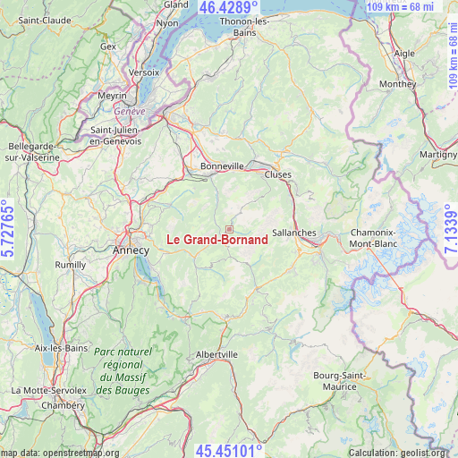
Le Grand-Bornand GPS coordinates[2]
45° 56' 31.596" North, 6° 25' 50.772" East
| Map corner | latitude | longitude |
|---|---|---|
| Upper-left | 46.4289°, | 5.72765° |
| Center: | 45.94211°, | 6.43077° |
| Lower-right: | 45.45101°, | 7.1339° |
| Map W x H: | 108.7×108.7 km | = 67.5×67.5mi |
| max Lat: | 51.07786° ⇑67% North |
| Le Grand-Bornand: | 45.94211° |
| min Lat: | ⇓33% South 41.3874° |
| min Long | Le Grand-Bornan | max Long |
| -5.08615° | 6.43077° | 9.52242° |
| W 91.3%⇐ | ⇒8.7% E |
Elevation
Elevation of Le Grand-Bornand is 983 m = 3225 ft, and this is 789.3 m = 2590 ft above average elevation for this country.
| Max E: |
2333 m = 7654 ft | 1% |
| Le Grand-Bornand | 983 m 3225 ft | |
| Avg. | 193.7 m = 635 ft | |
Min E: |
-1 m = -3 ft | 99% |
See also: France elevation on elevation.city.
Geographical zone
Le Grand-Bornand is located in North temperate zone (between Tropic of Cancer and the Arctic Circle). Distance of this North polar circle is 2292.9 km =1424.7 mi to North.| Distance of | km | miles | from Le Grand-Bornand |
|---|---|---|---|
| North Pole | 4898.8 | 3044 | to North |
| Arctic Circle | 2292.9 | 1424.7 | to North |
| Tropic Cancer | 2502.4 | 1554.9 | to South |
| Equator | 5108.3 | 3174.1 | to South |


Nearby cities:
15 places around Le Grand-Bornand: (largest is in red/bold)
• Cordon
13.7 km =8.5 mi,  99°
99°
• Entremont
3.5 km =2.2 mi,  295°
295°
• Flumet
15.2 km =9.4 mi,  154°
154°
• La Clusaz
3.9 km =2.4 mi,  175°
175°
• La Giettaz
10 km =6.2 mi, 150°
• Le Petit-Bornand-les-Glières
7 km =4.3 mi,  337°
337°
• Les Clefs
12 km =7.5 mi,  221°
221°
• Les Villards-sur-Thônes
5.3 km =3.3 mi,  234°
234°
• Manigod
9.9 km =6.2 mi,  205°
205°
• Mont-Saxonnex
12.5 km =7.8 mi,  15°
15°
• Saint-Jean-de-Sixt
2.6 km =1.6 mi, 214°
• Saint-Laurent
12.8 km =8 mi,  334°
334°
• Saint-Sixt
14.6 km =9.1 mi, 327°
• Thônes
10.6 km =6.6 mi, 230°
• Vougy
14.3 km =8.9 mi,  12°
12°
Sources, notices
• [Note1] Compared only with cities in France existing in our database
• [Src1] Map data: © OpenStreetMap contributors (CC-BY-SA)
• [Src2] Other city data from geonames.org with taken over terms of usage.
• [Src3] Geographical zone / Annual Mean Temperature by Robert A. Rohde @ Wikipedia
