Saint-Laurent geodata
Saint-Laurent (Auvergne-Rhône-Alpes) is a populated place; located in France in Europe/Paris (GMT+2) time zone. With population of 665 people, there are 12292 cities with bigger population in this country. Compared to other cities in France, 65.8% of cities are located further ↑North; 90.8% of cities are located further ←West and 96.3% of cities have lower elevation than Saint-Laurent. Note1
Administrative division(s):
- Level 1: Auvergne-Rhône-Alpes
- Level 2: Haute-Savoie
- Level 3: Arrondissement de Bonneville
- Level 4: Saint-Laurent


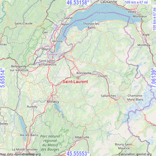
Saint-Laurent GPS coordinates[2]
46° 2' 44.556" North, 6° 21' 29.736" East
| Map corner | latitude | longitude |
|---|---|---|
| Upper-left | 46.53158°, | 5.65514° |
| Center: | 46.04571°, | 6.35826° |
| Lower-right: | 45.55553°, | 7.06139° |
| Map W x H: | 108.5×108.5 km | = 67.4×67.4mi |
| max Lat: | 51.07786° ⇑65.8% North |
| Saint-Laurent: | 46.04571° |
| min Lat: | ⇓34.2% South 41.3874° |
| min Long | Saint-Laurent | max Long |
| -5.08615° | 6.35826° | 9.52242° |
| W 90.8%⇐ | ⇒9.2% E |
Elevation
Elevation of Saint-Laurent is 665 m = 2182 ft, and this is 471.3 m = 1546 ft above average elevation for this country.
| Max E: |
2333 m = 7654 ft | 3.7% |
| Saint-Laurent | 665 m 2182 ft | |
| Avg. | 193.7 m = 635 ft | |
Min E: |
-1 m = -3 ft | 96.3% |
See also: France elevation on elevation.city.
Geographical zone
Saint-Laurent is located in North temperate zone (between Tropic of Cancer and the Arctic Circle). Distance of this North polar circle is 2281.4 km =1417.6 mi to North.| Distance of | km | miles | from Saint-Laurent |
|---|---|---|---|
| North Pole | 4887.3 | 3036.8 | to North |
| Arctic Circle | 2281.4 | 1417.6 | to North |
| Tropic Cancer | 2513.9 | 1562.1 | to South |
| Equator | 5119.8 | 3181.3 | to South |


Nearby cities:
15 places around Saint-Laurent: (largest is in red/bold)
• Amancy
3.8 km =2.4 mi,  323°
323°
• Arenthon
7.1 km =4.4 mi,  344°
344°
• Ayse
7.8 km =4.8 mi,  59°
59°
• Bonneville
5.4 km =3.4 mi,  44°
44°
• Cornier
7 km =4.3 mi, 318°
• Etaux
5.5 km =3.4 mi,  297°
297°
• La Roche-sur-Foron
5 km =3.1 mi, 304°
• Le Petit-Bornand-les-Glières
5.8 km =3.6 mi,  149°
149°
• Mont-Saxonnex
9 km =5.6 mi,  86°
86°
• Peillonnex
9.3 km =5.8 mi,  8°
8°
• Pers-Jussy
9.6 km =6 mi,  314°
314°
• Saint-Jean-de-Tholome
8 km =5 mi,  20°
20°
• Saint-Sixt
2.4 km =1.5 mi,  287°
287°
• Scientrier
8.2 km =5.1 mi, 341°
• Vougy
9.1 km =5.7 mi,  74°
74°
Sources, notices
• [Note1] Compared only with cities in France existing in our database
• [Src1] Map data: © OpenStreetMap contributors (CC-BY-SA)
• [Src2] Other city data from geonames.org with taken over terms of usage.
• [Src3] Geographical zone / Annual Mean Temperature by Robert A. Rohde @ Wikipedia
